place

New England

Census regions of the United StatesEnglish colonization of the AmericasHistory of New EnglandMaritime cultureMilitary history of New England
New EnglandRegions of the United StatesUse American English from September 2019Use mdy dates from October 2022Wikipedia indefinitely move-protected pages
Portland HeadLight (cropped)

New England is a region comprising six states in the Northeastern United States: Connecticut, Maine, Massachusetts, New Hampshire, Rhode Island, and Vermont. It is bordered by the state of New York to the west and by the Canadian provinces of New Brunswick to the northeast and Quebec to the north. The Gulf of Maine and Atlantic Ocean is to the east and southeast, and Long Island Sound is to the southwest. Boston is New England's largest city, as well as the capital of Massachusetts. Greater Boston is the largest metropolitan area, with nearly a third of New England's population; this area includes Worcester, Massachusetts (the second-largest city in New England), Manchester, New Hampshire (the largest city in New Hampshire), and Providence, Rhode Island (the capital of and largest city in Rhode Island). In 1620, the Pilgrims established Plymouth Colony, the second successful English settlement in America, following the Jamestown Settlement in Virginia founded in 1607. Ten years later, Puritans established Massachusetts Bay Colony north of Plymouth Colony. Over the next 126 years, people in the region fought in four French and Indian Wars, until the English colonists and their Iroquois allies defeated the French and their Algonquian allies in America. In the late 18th century, political leaders from the New England colonies initiated resistance to Britain's taxes without the consent of the colonists. Residents of Rhode Island captured and burned a British ship which was enforcing unpopular trade restrictions, and residents of Boston threw British tea into the harbor. Britain responded with a series of punitive laws stripping Massachusetts of self-government which the colonists called the "Intolerable Acts". These confrontations led to the first battles of the American Revolutionary War in 1775 and the expulsion of the British authorities from the region in spring 1776. The region played a prominent role in the movement to abolish slavery in the United States, and it was the first region of the U.S. transformed by the Industrial Revolution, initially centered on the Blackstone and Merrimack river valleys. The physical geography of New England is diverse. Southeastern New England is covered by a narrow coastal plain, while the western and northern regions are dominated by the rolling hills and worn-down peaks of the northern end of the Appalachian Mountains. The Atlantic fall line lies close to the coast, which enabled numerous cities to take advantage of water power along the many rivers, such as the Connecticut River, which bisects the region from north to south. Each state is generally subdivided into small municipalities known as towns, many of which are governed by town meetings. Unincorporated areas are practically nonexistent outside of Maine, and village-style governments common in other areas are limited to Vermont and Connecticut. New England is one of the U.S. Census Bureau's nine regional divisions and the only multi-state region with clear, consistent boundaries. It maintains a strong sense of cultural identity, although the terms of this identity are often contrasted, combining Puritanism with liberalism, agrarian life with industry, and isolation with immigration.

Excerpt from the Wikipedia article New England (License: CC BY-SA 3.0, Authors, Images).

New England
East Main Street,

Geographical coordinates (GPS) Address Nearby Places
placeShow on map

Wikipedia: New EnglandContinue reading on Wikipedia

Geographical coordinates (GPS)

Latitude Longitude
N 44 ° E -71 °
placeShow on map

Address

East Main Street

East Main Street
03813
New Hampshire, United States
mapOpen on Google Maps

Portland HeadLight (cropped)
Share experience

Nearby Places

Rivercroft Farm
Rivercroft Farm

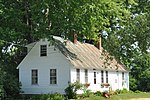
Rivercroft Farm is a historic farm complex on River Street (Maine State Route 113) in Fryeburg, Maine. The farm has been in the hands of the Weston family for many generations, and is one of the largest agricultural operations in Fryeburg. The centerpiece of the complex, on the south side of River Street, is a Second Empire house built 1870–73, and believed to be designed by Portland architect Frances H. Fassett. It is a 2+1⁄2-story wood-frame structure on a stone foundation. Its main block has a mansard roof; ells extend to the rear of the house that have gable roofs. The main facade is three bays wide, with a center entry flanked by paired sash windows, and a four-column porch extending across its width. The roof cornice and dormers have fine woodwork decoration typical of the Second Empire style.Adjacent to the house is the Yellow Barn, which was built sometime before 1880, and added to in c. 1950 and c. 1985. It is connected to a c. 1950 silo by a short single-story connector. The farm stand, which is also one of the older buildings in the complex, was originally used as a wagon shed, and was converted to its present use in the 1980s. An addition with modern facilities was added to the rear at that time. On the north side of River Street, across from the main complex, stands the White Cape. This 1+1⁄2-story wood frame Cape style house was built c. 1834.The first colonial settler of the farm was Henry Brown, who was granted land believed to be north of that granted to Joseph Frye, for whom Fryeburg is named. Brown sold the land when it was established that his grant fell within Fryeburg, and it was purchased in 1800 by Ephraim Weston. In the first half of the 19th century Weston and his successors amassed a significant number of land holdings in Fryeburg and surrounding towns in Maine and New Hampshire, reaching over 1,000 acres (400 ha) at its greatest extent. John Weston (1834-1909) specialized the farm for livestock production, and had what is now the main farmhouse built, replacing an older Federal-style house.A portion of the Weston's farm holdings, encompassing more than 185 acres (75 ha) and including their houses and major outbuildings, was listed on the National Register of Historic Places.

Marion Parsons House

The Marion Parsons House is a historic house at 179 Main Street in Fryeburg, Maine. It is located on the southeast side of Main Street, opposite River Street and two doors west of Elm Street. The main block of the house, built c. 1838 by a tailor named Robert Tonge, is a modest 1+1⁄2-story Cape style wood-frame structure with a gable roof. The exterior is finished in clapboards, with chimneys at either end. It is five bays wide, with a recessed center entry that is framed by sidelights and a molded architrave. A 1+1⁄2-story ell, an 1870s replacement for an earlier one, extends to the rear of the main block. This ell is attached to a 1+1⁄2-story barn which has Greek Revival styling.The house is most significant for its association with Marion Parsons (1876-1968), a pioneering nurse and nursing educator active in the early 20th century. Miss Parsons had a distinguished career, first as a nurse in hospitals in Boston and San Francisco, and was for two years a nursing instructor at New York City Hospital. During World War I she volunteered her services to the military, serving several tours of duty at military medical facilities in France. In 1919 she was dispatched by the American Red Cross to Czechoslovakia, where she established a nurse's training school. She is one of a small number of women to receive the Czech Order of the White Lion. She was also decorated with the British Royal Red Cross for her World War I service. She returned to a teaching position in Boston, and retired in 1940 to this house, which she had purchased in 1937; it was her only permanent home.The house was listed on the National Register of Historic Places in 1987.