place

Montpelier, Maryland

LevittownPrince George's County, Maryland geography stubsUnincorporated communities in MarylandUnincorporated communities in Prince George's County, MarylandUse mdy dates from July 2023
Washington metropolitan area

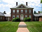
Montpelier, Prince George's County, Maryland, United States, (ZIP Codes 20708, 20709) is a suburban community outside the corporate boundaries of Laurel. Located near the Baltimore–Washington Parkway, it was built in the 1960s and early 1970s by Levitt & Sons. There are four models of houses in the Levitt style, with mirror images giving eight different floor plans. The Montpelier area has a history dating back to 1685, when it was part of a land grant given to Richard Snowden, Sr. by Lord Baltimore. Richard Snowden arrived in Maryland as an indentured servant and eventually became one of the largest landowners. The Snowden family built and lived in the Montpelier Mansion which remains a symbol of their success, financially and socially. The Montpelier community is a Planned Unit Development (PUD) and as such it has registered covenants and restrictions as set forth in Governing Documents dated January 1998. The purpose of these covenants is to provide a structured means of maintaining standards.

Excerpt from the Wikipedia article Montpelier, Maryland (License: CC BY-SA 3.0, Authors).

Montpelier, Maryland
Cedarbrook Lane,

Geographical coordinates (GPS) Address Nearby Places
placeShow on map

Wikipedia: Montpelier, MarylandContinue reading on Wikipedia

Geographical coordinates (GPS)

Latitude Longitude
N 39.0615 ° E -76.85081 °
placeShow on map

Address

Cedarbrook Lane 12411
20708
Maryland, United States
mapOpen on Google Maps

Share experience

Nearby Places

Dinosaur Park (Prince George's County, Maryland)

Dinosaur Park is a park located in the 13200 block of Mid-Atlantic Boulevard, near Laurel and Muirkirk, Maryland, and operated by the Prince George's County Department of Parks and Recreation. The park features a fenced area where visitors can join paleontologists and volunteers in searching for early Cretaceous fossils. The park also has an interpretive garden with plants and information signs. The park is in the approximate location of discoveries of Astrodon teeth and bones as early as the 19th century.In the 18th and 19th centuries, the clays of the Muirkirk Deposit in Prince George's County, Maryland were mined for siderite, or iron ore. Iron furnaces located throughout the region melted down siderite to produce iron and steel used in construction and manufacturing. In 1858, African-American miners working in open pit mines were the first to discover dinosaur fossils in Maryland.Among the first scientists to explore the Muirkirk Deposit was Maryland state geologist Phillip Thomas Tyson. He brought some of the strange bones discovered in the iron mines to a meeting of the Maryland Academy of Sciences in 1859, where his colleagues identified them as dinosaurs. Paleontologist Othniel Charles Marsh was also interested in Maryland fossils. In the winter of 1887, he sent John Bell Hatcher to search the iron mines. Hatcher recovered hundreds of fossils, including the remains of ancient turtles and crocodiles. In the 1890s, Smithsonian Institution scientists Charles Gilmore and Arthur Bibbins also visited Prince George's County, uncovering dinosaur teeth and other fossils that were added to the Smithsonian collection.In December 1995, the Maryland-National Capital Park and Planning Commission acquired 22 acres near Laurel, encompassing several Muirkirk Deposit exposure sites. The park protects these sites from development and unrestricted collecting, and provides an outdoor laboratory where the public can work alongside professional and amateur paleontologists to help uncover the past.