Haddington Hill

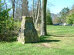
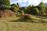
Haddington Hill (also called Wendover Hill) is a hill in The Chilterns, and the highest point in the English county of Buckinghamshire. On the north-eastern flank is Coombe Hill, not to be confused with another Coombe Hill 4 kilometres (2.5 mi) to the south-west. Haddington Hill is owned by the Forestry Commission, whose Wendover Woods cover much of the hill. Many tracks run through the forest, and a car park is located near the summit among the trees: the flat summit means the precise location of the highest point is difficult to determine with certainty. However, in the woods to the east of the car park there are a series of large stones bearing the inscription 'The Chiltern Summit'. The stones are surrounded by trees.
Excerpt from the Wikipedia article Haddington Hill (License: CC BY-SA 3.0, Authors, Images).Haddington Hill
Firecrest Trail,
Geographical coordinates (GPS) Address Nearby Places Show on map
Geographical coordinates (GPS)
| Latitude | Longitude |
|---|---|
| N 51.77171 ° | E -0.71154 ° |
Address
Firecrest Trail
Firecrest Trail
HP22 5NF
England, United Kingdom
Open on Google Maps


