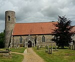
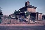
Ashby, Suffolk

Ashby is a former civil parish in the north of the English county of Suffolk. It is 5+1⁄2 miles (8.9 km) north-west of Lowestoft in the East Suffolk district. The parish was combined with Somerleyton and Herringfleet to form the combined parish of Somerleyton, Ashby and Herringfleet in 1987.The estimated population of Ashby was around 50 at the 2011 United Kingdom census. There is no village centre, with the population spread across a number of scattered farms and small settlements. The area has always been sparsely populated, with the former parish population never exceeding 110. At the 1981 United Kingdom census it had a population of 42.The county border with Norfolk is immediately north of Ashby. Fritton Decoy marks the northern border, with the Norfolk parishes of Belton with Browston and Fritton and St Olaves bordering Ashby. To the east it borders the Suffolk parish of Lound, with Herringfleet and Somerleyton to the west and south. Much of the land within the area of the former parish is owned by the Somerleyton Estate.
Excerpt from the Wikipedia article Ashby, Suffolk (License: CC BY-SA 3.0, Authors, Images).Ashby, Suffolk
Blocka Road, East Suffolk Somerleyton, Ashby and Herringfleet
Geographical coordinates (GPS) Address Nearby Places Show on map
Geographical coordinates (GPS)
| Latitude | Longitude |
|---|---|
| N 52.537 ° | E 1.668 ° |
Address
Blocka Road
NR32 5ND East Suffolk, Somerleyton, Ashby and Herringfleet
England, United Kingdom
Open on Google Maps


