place

Frankton, Warwickshire

Civil parishes in WarwickshireVillages in Warwickshire
Frankton
Frankton

Frankton is a village and civil parish in the Rugby borough of Warwickshire in England. In the 2001 Census it had a population of 344, increasing to 351 at the 2011 Census.

Excerpt from the Wikipedia article Frankton, Warwickshire (License: CC BY-SA 3.0, Authors, Images).

Frankton, Warwickshire

Geographical coordinates (GPS) Address Nearby Places
placeShow on map

Wikipedia: Frankton, WarwickshireContinue reading on Wikipedia

Geographical coordinates (GPS)

Latitude Longitude
N 52.33 ° E -1.38 °
placeShow on map

Address


CV23 9PH
England, United Kingdom
mapOpen on Google Maps

Frankton
Frankton
Share experience

Nearby Places

Birdingbury railway station

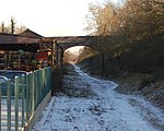
Birdingbury railway station was a railway station serving Birdingbury in the English county of Warwickshire on the Rugby to Leamington line. Among the many schemes to build a line between Rugby and Leamington was one by the Rugby, Leamington and Warwick Railway Company. This later became known as the Rugby and Leamington Railway and received Royal assent on 13 August 1846. It was sold to the London and North Western Railway almost immediately on 17 November 1846. It was not, however, until 1 March 1851 that the line opened with stations at Birdingbury and Marton, that at Dunchurch opening in 1871. Originally it was a single line, but was doubled in the 1880s, and the driveway leading to its level crossing was private property used by arrangement with the owners. The station building was of plain but substantial brick-built design and, on the opposite down platform, there was a waiting room with an awning (not present on the main platform). On the up side was a short double head shunt, with a siding leading to a loading stage. Unusually, on each platform was a small lever frame which could be used when the signal box was closed.At grouping in 1923 it became part of the London Midland and Scottish Railway. The goods yard closed in August 1953 and its track was lifted almost immediately. The station closed to passengers on 15 June 1959 when the Rugby and Leamington local service ended the track was lifted from Southam and is now a cycleway. The station buildings are now a private dwelling.

Marton, Warwickshire

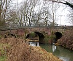
Marton is a village and civil parish in Warwickshire, England. The parish is within the Borough of Rugby and in the 2011 Census' had a population of 484. The hamlet of Marton Moor lies south of the village.Marton is on the A423 road between Coventry and Southam. To the north of the village is the River Leam and just to the west the River Itchen joins the Leam. Due to its proximity from these two rivers, parts of the village have periodically suffered from flooding.Marton was mentioned in the Domesday Book as Mortone. In the early Middle Ages it was a place of some importance, as it was the centre of a hundred named Meretone. By the late 12th century this had become part of the hundred of Knightlow.Just north of Marton is a medieval bridge over the River Leam known as Marton Bridge, which was built in 1414 by a locally born merchant called John Middleton. In 1928 a modern bridge was effectively built over the top of the medieval one, and it was hidden from view. However, in 2000 a new bridge was built alongside and the old bridge was uncovered and restored. The old bridge now carries pedestrians, while the modern bridge carries road traffic. Another point of interest in Marton is the Marton Museum of Country Bygones which has a collection of old agricultural implements. The village church of St Esprit is Grade II* listed.Marton used to have a a railway station on the former Rugby to Leamington Spa line, which was about half a mile south of the village, but this closed in 1959. There was also a junction called Marton Junction further south from the village, where the Rugby to Leamington Spa railway joined the Leamington to Weedon route.

Princethorpe
Princethorpe

Princethorpe is a village and civil parish in the Rugby district of Warwickshire, England. In the 2011 census the parish had a population 376, increasing to 429 at the 2021 census.Princethorpe is located roughly halfway between the towns of Rugby 6.5 miles (10.5 km) to the north-east, and Leamington Spa 6 miles (9.7 km) to the south-west. It is at the centre of a busy junction between the A423 (Coventry to Banbury), B4453 (Rugby to Leamington) and B4455 (Fosse Way) roads. The village contains a pub called the Three Horseshoes, which has been in business continuously since at least 1816. Situated on Leamington Road in the village is Our Lady's Primary School. It is a primary school with around 100 children between the ages of 4 and 11. Just outside the village is Princethorpe College, a Roman Catholic school. The school incorporates the buildings of the former St. Mary's Priory, which was founded by French Benedictine nuns from Montargis who sought asylum from the French Revolution in 1792. After several moves, they settled in Princethorpe in 1832, and established a priory and school. In 1966 it was purchased by the Missionaries of the Sacred Heart who established it into its present form.The village has a history extending to at least the Roman period, related to the fact that the Fosse Way, an old Roman road ran through it. Two Roman settlements existed just south of the current village. In the 1950s, a number of Roman coins were found in Princethorpe.Its name likely derived from an Anglo-Saxon farmer called Pren. It was first mentioned in 1275-6. In the reign of Henry VI it came into the possession of the Hugford family of Emscote and stayed in that family until the reign of Henry VII when John Hugford sold it to Sir William Compton. Princethorpe was originally in the parish of Wolston but was made, for convenience, a separate parish with Stretton by an Act of Parliament in 1694 the reign of William III. Princethorpe is today still part of the ecclesiastical parish of Stretton-on-Dunsmore, but became a separate civil parish in 1866.