Ouvèze
Auvergne-Rhône-Alpes geography stubsFrance river stubsPages with French IPAProvence-Alpes-Côte d'Azur geography stubsRivers of Auvergne-Rhône-Alpes ... and 5 more
Rivers of DrômeRivers of FranceRivers of Provence-Alpes-Côte d'AzurRivers of VaucluseTributaries of the Rhône

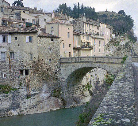
The Ouvèze (French pronunciation: [uvɛz]; Occitan: Ovesa) is a river in southern France and left tributary of the Rhône. It rises in the southern French Prealps (the Baronnies), in the commune of Montauban-sur-l'Ouvèze. It flows into the Rhône in Sorgues, north of Avignon. Its length is 93 km (58 mi). Its drainage basin is 1,919 km2 (741 sq mi). The Sorgue is one of its tributaries. The Ouvèze passes through the following départements and towns: Drôme: Buis-les-Baronnies, Mollans-sur-Ouvèze Vaucluse: Vaison-la-Romaine, Bédarrides, Sorgues
Excerpt from the Wikipedia article Ouvèze (License: CC BY-SA 3.0, Authors, Images).Ouvèze
Chemin de Terre des Combes, Avignon
Geographical coordinates (GPS) Address Nearby Places Show on map
Geographical coordinates (GPS)
| Latitude | Longitude |
|---|---|
| N 43.989722222222 ° | E 4.8525 ° |
Address
Ponton Kayak, Canoë ou Paddle
Chemin de Terre des Combes
84700 Avignon
Provence-Alpes-Côte d'Azur, France
Open on Google Maps


