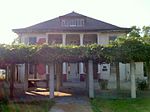
Rancho La Puente

Rancho La Puente was a ranch in the southern San Gabriel Valley that measured just under 49,000 acres (200 km2), and remained intact from its establishment in the late 1700s as an outpost of Mission San Gabriel until about 1870. By modern landmarks, the ranch extended from San Gabriel River on the west to just west of the 57 Freeway on the east and from Ramona Boulevard/San Bernardino Road on the north to the Puente Hills on the south. All but 40 acres (160,000 m2), which fall within Orange County, are within Los Angeles County. Today, the present communities of Avocado Heights, Bassett, Baldwin Park, San Dimas, Rowland Heights, Hacienda Heights, City of Industry, La Puente, Walnut, Covina, West Covina, and small sections of South El Monte and Irwindale are contained within the old boundaries of Rancho La Puente.
Excerpt from the Wikipedia article Rancho La Puente (License: CC BY-SA 3.0, Authors, Images).Rancho La Puente
North Nantes Avenue,
Geographical coordinates (GPS) Address Nearby Places Show on map
Geographical coordinates (GPS)
| Latitude | Longitude |
|---|---|
| N 34.03 ° | E -117.96 ° |
Address
North Nantes Avenue
North Nantes Avenue
91744
California, United States
Open on Google Maps


