place

HM Prison Perth

1842 establishments in Scotland19th-century establishments in ScotlandCategory A listed buildings in Perth and KinrossExecution sites in ScotlandListed buildings in Perth, Scotland
Listed prison buildings in ScotlandPrisons in Perth, ScotlandUse British English from February 2018
HMP Perth IMG 7040
HMP Perth IMG 7040

HM Prison Perth is a prison in Perth, Scotland that houses short term adult male prisoners (those prisoners serving under 4 years). It was originally constructed to hold French prisoners captured during the Napoleonic Wars, and is the oldest prison in Scotland that is still in use.

Excerpt from the Wikipedia article HM Prison Perth (License: CC BY-SA 3.0, Authors, Images).

HM Prison Perth
Edinburgh Road, Perth Upper Craigie

Geographical coordinates (GPS) Address Website External links Nearby Places
placeShow on map

Wikipedia: HM Prison PerthContinue reading on Wikipedia

Geographical coordinates (GPS)

Latitude Longitude
N 56.385555555556 ° E -3.43 °
placeShow on map

Address

HMP Perth

Edinburgh Road 3
PH2 8AT Perth, Upper Craigie
Scotland, United Kingdom
mapOpen on Google Maps

Website
sps.gov.uk

linkVisit website

linkWikiData (Q5635246)
linkOpenStreetMap (55685441)

HMP Perth IMG 7040
HMP Perth IMG 7040
Share experience

Nearby Places

South Inch
South Inch

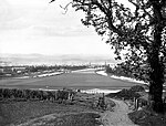
South Inch is a large public park in Perth, Scotland. About 31 hectares (77 acres) in size, it is one of two "Inches" in Perth, the other being the larger, 57-hectare North Inch, located half a mile across the city. The Inches were granted to the city, when it was a royal burgh, by King Robert II in 1374. Both Inches were once islands in the River Tay. The two Inches are connected by Tay Street. The park is bounded by King's Place and Marshall Place (both part of the A989, the latter named for Perth lord provost Thomas Hay Marshall) to the north, Shore Road to the east and South Inch View and South Inch Terrace at its southern extremity. Its western boundary abuts the rear of the homes on St Leonard's Bank, which was laid out by Perth architect William Macdonald Mackenzie in 1828. The north-south running A912 Edinburgh Road, opened around 1760, passes through the park's eastern third. The eastern side of the park is known as the Lesser South Inch.Two paths diagonally dissect the main part of the park. The start of the path that originates from the northwest corner, at the foot of King Street, is overlooked by a statue of Sir Walter Scott, author of The Fair Maid of Perth in 1828. The statue, a Category C listed monument, is the work of the Cochrane brothers, and was completed in 1845 as one of their final works before leaving for Canada. It was accidentally acquired by the city magistrates at the sale of a local sculptor's stock. The part of the statue of Scott's dog, Maida, was stolen in 2020. It was also stolen in 2016.Craigie Burn enters the inch at its southwestern corner, via a tunnel, after passing beneath the Highland Main Line railway. It then runs along the inch's southern edge before going underground and exiting into the Tay. The category C listed buildings at 1 and 2 St Leonard's Bank, currently occupied by the Parklands Hotel, overlook the Inch's northwestern corner.

Perth Water Works
Perth Water Works

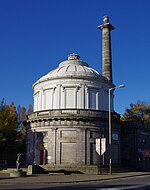
Perth Water Works (also known as Corporation Water Works) is an historic building in Perth, Scotland, dating to 1832. Standing at the corner of Tay Street and Marshall Place (both part of the A989), the building, a former engine house and water tank, has been the home of The Fergusson Gallery, displaying the work of John Duncan Fergusson, since 1992. The building is Category A listed. Historic Environment Scotland states that it is one of Scotland's most significant industrial buildings, and that its large-scale cast-iron construction may be the first very first in the world.Clean water was drawn from filter beds on Moncreiffe Island, in the adjacent River Tay, and pumped beneath the river, by a steam engine, into a 146,000 imperial gallons (660,000 L; 175,000 US gal) holding tank in the building's rotunda.The building's architect was Adam Anderson, the rector of Perth Academy.An inscription over the door in the rotunda reads Aquam Igne Et Aqua Haurio ("I draw water by fire and water").The engine house has a tall Doric columned chimney, capped by a Roman urn (a fibreglass replica of the original, which was destroyed by a lightning strike in 1871).The building became surplus to requirements in 1965, when the city opened a new water works. It was restored in 1973, for use as a Tourist Information Centre, by James Morris and Robert Steedman, and then converted to its current use nineteen years later. Its dome was reconstructed in 2003 as part of a restoration funded by the Heritage Lottery, Historic Scotland and Perth and Kinross Council.

Greyfriars Burial Ground

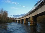
Greyfriars Burial Ground is an historic cemetery in Perth, Scotland, dating to 1580. It is now Category A listed.It occupies the former location of the Greyfriars Monastery, founded by Laurence Oliphant, 1st Lord Oliphant, in 1496 and destroyed in 1559 at the start of the Scottish Reformation.Its collection of gravestones is considered one of the best in Scotland.As per documentation dating to 1911, "no burial is permitted of the body of a person who at the time of death resided out of the old parish, excepting that of a widower or widow, son or daughter who have never been married." A superintendent was in attendance every morning between 10 and 11 AM, then between 11 AM and 1 PM at Wellshill Cemetery.The cemetery closed to burials in 1978. The cemetery is located at the eastern end of Canal Street, near its junction with Tay Street. It has been extended south on two occasions, and it now abuts the bridge carrying the Perth to Dundee section of the Scottish railway network. A tablet commemorating John Mylne, who "rebuilt the ancient bridge over the River Tay," was erected by Robert Mylne in 1784.In 1997, when proposals were made to dismantle and rebuild the cemetery's eastern wall, two test pits were dug by the Scottish Urban Archaeological Trust (SUAT). One of the pits found what is believed to be the original monastery wall foundations. A "succession of wall foundations" hinted at several wall replacement and repair efforts undertaken during the monastery's lifespan, each raising the ground level. Medieval pottery was also discovered, likely associated with the soil of lower garden abutting the original monastery wall. The other pit demonstrated a lack of a progression of wall foundations, confirming that that area was inside the 1795 graveyard extension and outside the original monastery grounds. The second pit also showed signs of infilling or levelling layers, possibly from when a burn, which ran along the burial ground's southern wall, was covered with soil.In 2019, several headstones deemed a hazard to passersby were removed and restored.