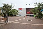
Horsley, New South Wales
Illawarra region geography stubsSuburbs of WollongongUse Australian English from August 2019

Horsley is a suburb in Wollongong. It is the location of the new Dapto Primary school and a community centre. This suburb has expanded since 1999 and contains many newly developed houses.
Excerpt from the Wikipedia article Horsley, New South Wales (License: CC BY-SA 3.0, Authors, Images).Horsley, New South Wales
Shone Avenue, Wollongong City Council Horsley
Geographical coordinates (GPS) Address Nearby Places Show on map
Geographical coordinates (GPS)
| Latitude | Longitude |
|---|---|
| N -34.483333333333 ° | E 150.76666666667 ° |
Address
Shone Avenue
Shone Avenue
2530 Wollongong City Council, Horsley
New South Wales, Australia
Open on Google Maps


