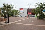
Huntley, New South Wales (Wollongong)
Illawarra region geography stubsSuburbs of WollongongUse Australian English from August 2019
Huntley is a suburb of the City of Wollongong to the west of Dapto. At the 2016 census, it had a population of 50.The Geographical Names Board of New South Wales assigned the name of Huntley to the suburb on 5 August 2005. It had previously been called West Dapto or considered to be part of Avondale. It was named after a coal mine located within its boundary. The mine's name "Huntley" came from Huntly, a coal mining town in the North Island of New Zealand, which originally had this spelling. The original owners of the Huntley colliery, Illawarra Coal, had associations with the New Zealand mine.
Excerpt from the Wikipedia article Huntley, New South Wales (Wollongong) (License: CC BY-SA 3.0, Authors).Huntley, New South Wales (Wollongong)
Bong Bong Road, Wollongong City Council Huntley
Geographical coordinates (GPS) Address Nearby Places Show on map
Geographical coordinates (GPS)
| Latitude | Longitude |
|---|---|
| N -34.497222222222 ° | E 150.73527777778 ° |
Address
Bong Bong Road
Bong Bong Road
2530 Wollongong City Council, Huntley
New South Wales, Australia
Open on Google Maps


