Bridgeton flood of 1934
The Flood of 1934 was a natural disaster that hit the town of Bridgeton, New Jersey on August 2 and 3, 1934. Over the course of three days, storms brought 7 inches (180 mm) of rain to the region, swelling Sunset Lake and other local interconnected waterways. At the time, there were two earthen dams holding the water back at Sunset Lake and Mary Elmer Lake. Eventually the pressure was too much and the dams gave way sending a torrent of water down the Cohansey River as well as tributaries connected to the Lakes. The wall of water surged down through the banks of the Cohansey, emptying the lakes and the Raceway and flowing into and through downtown Bridgeton, which straddles the river. All the bridges that connected the east and west sides of the town were destroyed. Also damaged was Tumbling Dam Park, where the dam that held the water of Sunset Lake was located. An estimated $1 million (equivalent to $21.9 million in 2022) in damage was caused by the flooding.
Excerpt from the Wikipedia article Bridgeton flood of 1934 (License: CC BY-SA 3.0, Authors).Bridgeton flood of 1934
Bank Street,
Geographical coordinates (GPS) Address Nearby Places Show on map
Geographical coordinates (GPS)
| Latitude | Longitude |
|---|---|
| N 39.429564 ° | E -75.230461 ° |
Address
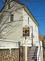
Bank Street School
Bank Street
08302
New Jersey, United States
Open on Google Maps


