Cormier Woods
2008 establishments in MassachusettsBuildings and structures in Uxbridge, MassachusettsFarms in MassachusettsOpen space reserves of MassachusettsProtected areas established in 2008 ... and 4 more
Protected areas of Worcester County, MassachusettsThe Trustees of ReservationsUxbridge, MassachusettsWorcester County, Massachusetts geography stubs

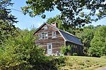
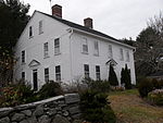
Cormier Woods is a 175-acre (71 ha) open space preserve and historic 18th-century farm complex in Uxbridge, Massachusetts, USA, within the Blackstone River Valley National Heritage Corridor. The property is named for James Cormier, the former owner of the property. It was acquired in 2008 by the land conservation non-profit organization The Trustees of Reservations. The reservation includes 3 miles (4.8 km) of hiking trails, farmland, woodlots, wetlands, a farmhouse, barn and sheds. It is open to hiking, picnicking, cross country skiing and hunting (in season). The reservation trailhead is on Chapin Street in Uxbridge.
Excerpt from the Wikipedia article Cormier Woods (License: CC BY-SA 3.0, Authors, Images).Cormier Woods
East Street,
Geographical coordinates (GPS) Address External links Nearby Places Show on map
Geographical coordinates (GPS)
| Latitude | Longitude |
|---|---|
| N 42.068888888889 ° | E -71.593888888889 ° |
Address
Cormier Woods
East Street
01529
Massachusetts, United States
Open on Google Maps
