Suša, Gorenja Vas–Poljane
Gorenja vas-Poljane geography stubsPages with Slovene IPAPopulated places in the Municipality of Gorenja vas-Poljane

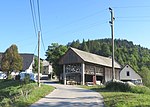
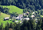
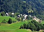
Suša (pronounced [ˈsuːʃa]) is a small settlement northeast of Hotavlje in the Municipality of Gorenja Vas–Poljane in the Upper Carniola region of Slovenia. It lies below the southeast slope of Mount Blegoš, at the confluence of Karlovščica and Zarobarščica creeks, where they join to form Logarščica Creek.
Excerpt from the Wikipedia article Suša, Gorenja Vas–Poljane (License: CC BY-SA 3.0, Authors, Images).Suša, Gorenja Vas–Poljane
Gorenja vas-Poljane
Geographical coordinates (GPS) Address Nearby Places Show on map
Geographical coordinates (GPS)
| Latitude | Longitude |
|---|---|
| N 46.136313888889 ° | E 14.138022222222 ° |
Address
4223 Gorenja vas-Poljane
Slovenia
Open on Google Maps


