Revesby, New South Wales
City of Canterbury-BankstownSuburbs of SydneyUse Australian English from August 2019

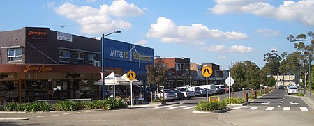
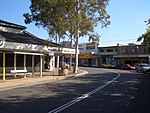
Revesby, a suburb of local government area City of Canterbury-Bankstown, is located 22 kilometres south-west of the Sydney central business district, in the state of New South Wales, Australia, and is a part of the South-western Sydney region. Revesby is mostly a residential suburb, which was developed as part of Sydney's post-war urban sprawl, and contains many modest freestanding bungalows built from asbestos cement sheeting (fibro). Revesby is bounded on the north by Canterbury Road and the suburbs of Bankstown and Condell Park, on the south by Revesby Heights and Picnic Point, on the Georges River, on the west by Panania, and on the east by Padstow.
Excerpt from the Wikipedia article Revesby, New South Wales (License: CC BY-SA 3.0, Authors, Images).Revesby, New South Wales
Harrison Street, Sydney Revesby
Geographical coordinates (GPS) Address Nearby Places Show on map
Geographical coordinates (GPS)
| Latitude | Longitude |
|---|---|
| N -33.95 ° | E 151.01027777778 ° |
Address
Harrison Street
Harrison Street
2212 Sydney, Revesby
New South Wales, Australia
Open on Google Maps


