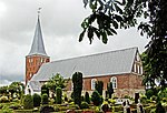
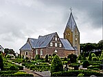
Løgumkloster Municipality
Løgumkloster Municipality named for the town Løgumkloster, existed until 1 January 2007, covering an area of 200 km2 and with a total population of 6,846 (2005). Its last mayor was Kaj Armann, a member of the Venstre (Liberal Party) political party. The municipality was created in 1970 as the result of a kommunalreform ("Municipality Reform") that combined a number of existing parishes: Bedsted Parish Højst Parish Løgumkloster Parish Nørre Løgum Parish.Løgumkloster Municipality ceased to exist due to Kommunalreformen ("The Municipality Reform" of 2007). It was merged with Bredebro, Højer, Nørre-Rangstrup, Skærbæk, and Tønder municipalities to form an enlarged Tønder municipality. This created a municipality with an area of 1,352 km2 and a total population of 42,645 (2005).
Excerpt from the Wikipedia article Løgumkloster Municipality (License: CC BY-SA 3.0, Authors).Løgumkloster Municipality
Refugievej, Tønder Municipality
Geographical coordinates (GPS) Address Nearby Places Show on map
Geographical coordinates (GPS)
| Latitude | Longitude |
|---|---|
| N 55.056944444444 ° | E 8.9533333333333 ° |
Address
Refugievej
6240 Tønder Municipality
Region of Southern Denmark, Denmark
Open on Google Maps


