Jutland
Geography of DenmarkGeography of GermanyJutlandPages including recorded pronunciationsPages with Danish IPA ... and 6 more
Pages with German IPAPages with Old English IPAPeninsulas of DenmarkPeninsulas of EuropePeninsulas of Schleswig-HolsteinPeninsulas of the Baltic Sea

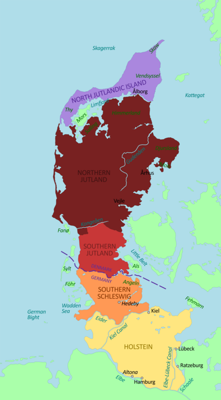
Jutland (Danish: Jylland [ˈjyˌlænˀ]) is a peninsula of Northern Europe that forms the continental portion of Denmark and part of northern Germany. Jutland's geography is flat, similar to the rest of Denmark, with comparatively steep hills in the east and a barely noticeable ridge running through the center. West Jutland is characterised by open lands, heaths, plains, and peat bogs, while East Jutland is more fertile with lakes and lush forests. Southwest Jutland is characterised by the Wadden Sea, a large unique international coastal region stretching through Denmark, Germany, and the Netherlands.
Excerpt from the Wikipedia article Jutland (License: CC BY-SA 3.0, Authors, Images).Jutland
Ellehusvej, Tønder Municipality
Geographical coordinates (GPS) Address Show on map
Geographical coordinates (GPS)
| Latitude | Longitude |
|---|---|
| N 55 ° | E 9 ° |
Address
Konfluenspunkt 55°N 9°E
Ellehusvej
Tønder Municipality
Region of Southern Denmark, Denmark
Open on Google Maps