place

Westcott, Surrey

Mole ValleyUse British English from June 2016Villages in Surrey
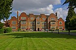
Westcott geograph.org.uk 135569

Westcott is a semi-rural English village and former civil parish 1.5 miles (2.4 km) west of the centre of Dorking on the A25 between the North Downs and Greensand Ridge, making it one of the 'Vale of Holmesdale' villages (greatly in Westcott an AONB) and is in Surrey in the direction of Guildford. It is served by a local bus service and is 1 mile (1.6 km) from Dorking West railway station on the North Downs Line.

Excerpt from the Wikipedia article Westcott, Surrey (License: CC BY-SA 3.0, Authors, Images).

Westcott, Surrey
Broomfield Park, Mole Valley

Geographical coordinates (GPS) Address Nearby Places
placeShow on map

Wikipedia: Westcott, SurreyContinue reading on Wikipedia

Geographical coordinates (GPS)

Latitude Longitude
N 51.224 ° E -0.362 °
placeShow on map

Address

Broomfield Park 9
RH4 3QG Mole Valley
England, United Kingdom
mapOpen on Google Maps

Westcott geograph.org.uk 135569
Share experience

Nearby Places

Dorking
Dorking

Dorking () is a market town in Surrey in South East England, about 34 km (21 mi) south of London. It is in Mole Valley District and the council headquarters are to the east of the centre. The High Street runs roughly east–west, parallel to the Pipp Brook and along the northern face of an outcrop of Lower Greensand. The town is surrounded on three sides by the Surrey Hills Area of Outstanding Natural Beauty and is close to Box Hill and Leith Hill. The earliest archaeological evidence of human activity is from the Mesolithic and Neolithic periods, and there are several Bronze Age bowl barrows in the local area. The town may have been the site of a staging post on Stane Street during Roman times, however the name 'Dorking' suggests an Anglo-Saxon origin for the modern settlement. A market is thought to have been held at least weekly since early medieval times and was highly regarded for the poultry traded there. The Dorking breed of domestic chicken is named after the town. The local economy thrived during Tudor times, but declined in the 17th century due to poor infrastructure and competition from neighbouring towns. During the early modern period many inhabitants were nonconformists, including the author, Daniel Defoe, who lived in Dorking as a child. Six of the Mayflower Pilgrims, including William Mullins and his daughter Priscilla, lived in the town before setting sail for the New World. Dorking started to expand during the 18th and 19th centuries as transport links improved and farmland to the south of the centre was released for housebuilding. The new turnpike, and later the railways, facilitated the sale of lime produced in the town, but also attracted wealthier residents, who had had no previous connection to the area. Residential expansion continued in the first half of the 20th century, as the Deepdene and Denbies estates began to be broken up. Further development is now constrained by the Metropolitan Green Belt, which encircles the town.