place

Ross Creek Reservoir

1860s architecture in New ZealandBuildings and structures in DunedinGeography of DunedinHeritage New Zealand Category 1 historic places in OtagoLakes of Otago
Leith ValleyProtected areas of OtagoReservoirs in New Zealand
Ross Creek Reservoir

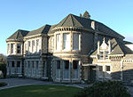
The Ross Creek Reservoir is an artificial lake in Dunedin, New Zealand. One of the oldest artificial lakes in the country, and the oldest water supply reservoir still in use in the country, it was created in the 1860s to provide water for the city of Dunedin, at that time in the middle of rapid expansion due to the Otago goldrush. Designed by engineer Ralph Donkin and supervising builder David Proudfoot, the reservoir was opened in 1867 as the Royal Albert Reservoir, but the name was unpopular and it has been known as the Ross Creek Reservoir for over a century. The reservoir, dams, and picturesque valve tower have a New Zealand Historic Places Trust Level I classification. The reservoir is located in a heavily wooded valley in the suburb of Glenleith, four kilometres north of the city centre. Fed by a small stream, the Ross Creek — a tributary of the Water of Leith — it is held behind two small dams, 23 metres and 10 metres in height. The base of the larger dam is 95 metres above sea level, with the water surface at approximately 115 metres ASL.

Excerpt from the Wikipedia article Ross Creek Reservoir (License: CC BY-SA 3.0, Authors, Images).

Ross Creek Reservoir
Ross Creek Reservoir Trail, Dunedin Glenleith

Geographical coordinates (GPS) Address Nearby Places
placeShow on map

Wikipedia: Ross Creek ReservoirContinue reading on Wikipedia

Geographical coordinates (GPS)

Latitude Longitude
N -45.8471 ° E 170.4986 °
placeShow on map

Address

Ross Creek Reservoir Trail

Ross Creek Reservoir Trail
9010 Dunedin, Glenleith
Otago, New Zealand
mapOpen on Google Maps

Ross Creek Reservoir
Share experience

Nearby Places

Maori Hill
Maori Hill

Māori Hill is a residential suburb of the New Zealand city of Dunedin. It is located at the northern end of the ridge which runs in a crescent around the central city's western edge, 2 kilometres (1.2 mi) to the northwest of the city centre, immediately above and within the Town Belt. It is connected to Dunedin North, which lies to the east, via Drivers Road, the suburbs of Roslyn and Kaikorai to the southwest via Highgate, and the suburb of Wakari to the northwest via Balmacewen Road. In the northeast of the suburb lies the recreational ground of Prospect Park, and this part of Māori Hill is also often known by this name. From Prospect Park, views across the lower Leith Valley can be obtained, as the park sits close to the edge of cliffs which rise above the broad canyon at Woodhaugh. A steep walking track, the Bullock Track, links the two suburbs. Māori Hill is regarded as one of the city's wealthier and more exclusive suburbs, and contains many fine houses, especially in the maze of winding streets which run through the bush-clad slopes of the Town Belt. These houses include the historic manor Olveston, which has been owned by the city and open to the public since the 1960s. Unlike neighbouring hill suburbs like Roslyn, Māori Hill was not served by a cable car, possibly underlying its greater degree of exclusivity. Notable features of Māori Hill include the Balmacewen Golf Course, home of the Otago Golf Club, in the suburb's northwest. This is one of New Zealand's oldest and finest courses. A state integrated Presbyterian boys' secondary school, John McGlashan College, is located close to the golf course. To the southeast of the course lies a recreation ground, Bishopscourt, and nearby is Balmacewen Intermediate School. As with Prospect Park, this area is often referred to as a separate suburb, Balmacewen, named after the residence of early settler John McGlashan, whose wife's maiden name was McEwen. To the northwest of the golf course is an area of scenic reserve which surrounds the Ross Creek Reservoir in Glenleith. Several popular walking tracks lead down to the reservoir from Cannington Road, which marks the northern edge of Māori Hill. Other schools in Māori Hill include Māori Hill School, a state primary school. On the Roslyn/Kaikorai/Māori Hill border is Columba College, a state integrated Presbyterian girls secondary school, with a coeducational Junior (primary) school. Māori Hill contains the city's largest private hospitals. Formerly known as the Mater Misericordiae, it is now the Mercy Hospital, and contains as part of its complex the Marinoto Clinic. This is located on Newington Avenue, one of several streets which wind down into the Town Belt from Highgate. The hospital is built around Marinoto, the former home of the Sargood family and now one of the hospital's major buildings.

Wakari

Wakari ( wah-kah-ree) is a residential suburb of the New Zealand city of Dunedin. It is located 2.5 kilometres (1.6 mi) to the northwest of the city centre, immediately to the west of the ridge which runs to the west of the city's centre. Wakari lies to the north of the upper reaches of the Kaikorai Valley, and is also north of the suburb of Kaikorai. The suburbs of Roslyn and Maori Hill are situated on the ridge immediately to the southeast and east of Wakari. The suburb of Halfway Bush lies to the northwest, and the smaller suburb of Helensburgh lies to the north. Wakari is an anglicisation of the Māori Whakaari, "exposed to view". This is the Māori name for the hill, Flagstaff, which lies 2.5 kilometres (1.6 mi) to the northwest. A shibboleth is that many (though not all) local residents pronounce the name as "wy-kar-ree" (). The suburb is bounded in the south by Taieri Road, a main suburban arterial route which links central Dunedin with the Taieri Plains. West of Halfway Bush, the road becomes Three Mile Hill Road, crossing the eponymous hill to reach the Taieri Plain northeast of Mosgiel. To the southeast of Wakari, Taieri Road runs under the Roslyn Overbridge and becomes Stuart Street, one of central Dunedin's main streets. Other main roads in and around Wakari include Balmacewen Road in the northern part of the suburb, Helensburgh Road in the northeast, Nairn Street, and Shetland Street. Wakari's most prominent structure is the Wakari Hospital, one of Dunedin's main health care centres, which specialises in psychiatric services. This hospital is located in the west of the suburb, close to its boundary with Halfway Bush. Arai te Uru Marae is also located in Wakari. It is a marae (meeting ground) of Ngāi Tahu and includes Arai te Uru wharenui (meeting house). It is next to Balmacewen Intermediate School.