Cartierville Airport

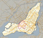
Cartierville Airport (formerly IATA: YCV, ICAO: CYCV) was an airport in Saint-Laurent, Quebec, now a borough of Montreal. The airport (Bois-Franc Field when it opened in 1911 and during World War I) was decommissioned in 1988 and turned into the Bois-Franc neighbourhood. It was located next to Route 117 (now Boul. Marcel Laurin, formerly Laurentian Blvd.) and the terminal buildings were accessed via Boul. Henri-Bourassa (formerly Rue Bois Franc), near the present Bois-Franc Train Station on the Deux Montagnes Commuter Rail Line.As the 10/28 runway's threshold was very close to Bois-Franc Boulevard (now Boul. Henri-Bourassa West), a traffic light was installed and automobile traffic was stopped by Air Traffic Control whenever a plane was about to take off from runway 28 or land on runway 10. In 1928 Reid Aircraft Company (and shortly by Curtiss Aeroplane & Motor Company as Curtiss-Reid) opened a plant to make Curtiss-Reid Rambler, then in 1935 Noorduyn opened an aircraft plant followed by Canadian Vickers in 1942. At one time, Canadair Plant One used the airfield to fly off completed CL-215, CL-415, Challenger bizjets and Canadair Regional Jets. The airport was closed to private and commercial passenger traffic in the 1980s when it became apparent that traffic from the nearby Dorval Airport was making it hazardous for chartered flights and flight schools to operate on the site. This left Bombardier as the sole user. Prior to Bombardier's acquisition of Canadair, Canadair had already acquired title to the airport, and had initiated a subdivision development planning.Among the aircraft test-flown there was the Canadair CL-84 Dynavert tilt-wing VTOL airplane.
Excerpt from the Wikipedia article Cartierville Airport (License: CC BY-SA 3.0, Authors, Images).Cartierville Airport
Boulevard Henri-Bourassa Ouest, Montreal Saint-Laurent
Geographical coordinates (GPS) Address Nearby Places Show on map
Geographical coordinates (GPS)
| Latitude | Longitude |
|---|---|
| N 45.516666666667 ° | E -73.716666666667 ° |
Address
Boulevard Henri-Bourassa Ouest 5770
H4R 3C8 Montreal, Saint-Laurent
Quebec, Canada
Open on Google Maps


