place

Buckland, Portsmouth

Areas of PortsmouthHampshire geography stubs

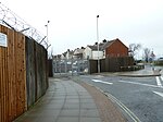
Buckland is a residential area in the city of Portsmouth in the English county of Hampshire.

Excerpt from the Wikipedia article Buckland, Portsmouth (License: CC BY-SA 3.0, Authors).

Buckland, Portsmouth
Binsteed Road, Portsmouth Fratton

Geographical coordinates (GPS) Address Nearby Places
placeShow on map

Wikipedia: Buckland, PortsmouthContinue reading on Wikipedia

Geographical coordinates (GPS)

Latitude Longitude
N 50.81 ° E -1.075 °
placeShow on map

Address

Binsteed Road

Binsteed Road
PO2 7PJ Portsmouth, Fratton
England, United Kingdom
mapOpen on Google Maps

Share experience

Nearby Places

Portsea Island
Portsea Island

Portsea Island is a flat and low-lying natural island 24.5 square kilometres (9.5 sq mi; 6,100 acres) in area, just off the southern coast of Hampshire in England. Portsea Island contains the majority of the city of Portsmouth. Portsea Island has the third-largest population of all the islands in the British Isles after the mainlands of Great Britain and Ireland; it also has the highest population density of any British Isle, and Portsmouth has the highest population density of any city in the UK outside of London.To the east of Portsea Island lies Hayling Island, separated by Langstone Harbour. To the west is the peninsular mainland town of Gosport, separated by Portsmouth Harbour. To the south, it faces into the Spithead area of the wider Solent. A narrow tidal channel along the northern edge of Portsea Island, known as Portsea Creek, separates Portsea Island from the mainland.Three roads connect Portsea Island to the mainland road network; the M275 motorway, the A3 London Road (split on two separate bridges) and the A2030 Eastern Road. There are also two pedestrian and bicycle bridges over Portsea Creek. In Portsmouth Harbour, a road bridge connects Portsea Island to Whale Island, a restricted Royal Navy shore base establishment. Portsea Island has four railway stations (Portsmouth Harbour, Portsmouth & Southsea, Fratton and Hilsea) connected by an island branch line to the mainland railway network via a short railway bridge over Portsea Creek. In addition there are ferry services to Gosport (on the mainland), Hayling Island and the Isle of Wight. There are also ferries to the Channel Islands, northern France and northern Spain. Portsea Island gives its name to a neighbourhood of Portsmouth historically known as The Common, now formally known as Portsea and also the Portsea Parish of the island.

Stamshaw
Stamshaw

Stamshaw is a residential district of Portsmouth, located on the north western corner of Portsea Island in southern England. Much of it consists of dense rows of "two up, two down" terraced housing built during the late 19th century and early 20th century for dockyard workers and their families. Due to the rising cost of houses in the south in recent years, it has become one of the key areas for first time buyers.The area once included a greyhound racing stadium (closed 2010 April and since has been demolished), Alexandra Park, with the Mountbatten Sports Centre, and Portsmouth International Port. To the north lie Tipner and Hilsea, and to the south are Kingston, Buckland and Commercial Road, the main retail area of the city. Stamshaw is bounded to its west by the M275 motorway and Whale Island, and to the east is North End. The main thoroughfares of Stamshaw are Twyford Avenue and Stamshaw Road, the two parts of a one-way traffic system that runs on a north–south axis to Northern Parade in Hilsea. The local middle school is Stamshaw Junior School, and there is Stamshaw Infant School too. Stamshaw Park has fields and an adventure playground. In 1804 a Royal Powder Works was established on Stamshaw Point in connection with the gunpowder magazine at Tipner; by 1833, however, it had ceased operation, and no above-ground evidence of the site remains to be seen.The area is home to St Saviour church of England church built between 1913 and 1914.