River Kennet
EngvarB from October 2013Geography of Reading, BerkshireKennet and Avon CanalKennet catchmentRiver navigations in the United Kingdom ... and 6 more
Rivers of BerkshireRivers of WiltshireSites of Special Scientific Interest in BerkshireSites of Special Scientific Interest in WiltshireSites of Special Scientific Interest notified in 1995West Berkshire District

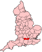
The Kennet is a tributary of the River Thames in Southern England. Most of the river is straddled by the North Wessex Downs AONB (Area of Outstanding Natural Beauty). The lower reaches have been made navigable as the Kennet Navigation, which – together with the Avon Navigation, the Kennet and Avon Canal and the Thames – links the cities of Bristol and London. The length from near its sources west of Marlborough, Wiltshire down to Woolhampton, Berkshire is a 111.1-hectare (275-acre) biological Site of Special Scientific Interest (SSSI). This is primarily from an array of rare plants and animals completely endemic to chalky watercourses.When Wiltshire had second-tier local authorities, one, Kennet District, took the name of the river.
Excerpt from the Wikipedia article River Kennet (License: CC BY-SA 3.0, Authors, Images).Geographical coordinates (GPS)
| Latitude | Longitude |
|---|---|
| N 51.459148 ° | E -0.94947 ° |


