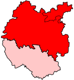
Risbury
Herefordshire geography stubsVillages in Herefordshire

Risbury is a village in the civil parish of Humber in Herefordshire, England, and 4 miles (6 km) south-east of Leominster. There used to be a Methodist chapel, a post office and The Hop Pole public house in the village, but all three are now residential dwellings. At Risbury cross there is a bus shelter, however the accompanying red phone box was decommissioned in 2018 and moved to the village hall opposite to house a defibrillator. Risbury Camp, an Iron Age hill fort, is just outside the village on private farmland, although a public footpath runs nearby. There is a green burial ground, Humber Woodland of Remembrance, outside within the parish.
Excerpt from the Wikipedia article Risbury (License: CC BY-SA 3.0, Authors, Images).Risbury
Poplands Lane,
Geographical coordinates (GPS) Address Nearby Places Show on map
Geographical coordinates (GPS)
| Latitude | Longitude |
|---|---|
| N 52.1921 ° | E -2.6621 ° |
Address
Poplands Lane
Poplands Lane
HR6 0NN
England, United Kingdom
Open on Google Maps


