San Bartolomé de Tirajana

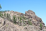
San Bartolomé de Tirajana is a village and a Spanish municipality in the south-eastern part of the island of Gran Canaria in the Las Palmas province in the Canary Islands. With an area of 333.13 km2 (128.62 sq mi), San Bartolomé de Tirajana is the largest municipality in area on the island as well as the Canary Islands. The population is 56,698 (2013).The municipality contains the large beach resorts of Maspalomas, including Playa del Inglés and San Agustín, and the Pilancones natural park. The municipal capital, the village of San Bartolomé de Tirajana is situated in the mountains, 17 km (11 mi) from the coast and 27 km (17 mi) south-west of Las Palmas, at about 900 m (2,953 ft) elevation. Most of the population lives along the Atlantic coastline. The GC-1 motorway passes through the southern part of the municipality, and connects it with Las Palmas de Gran Canaria and the Gran Canaria Airport.
Excerpt from the Wikipedia article San Bartolomé de Tirajana (License: CC BY-SA 3.0, Authors, Images).San Bartolomé de Tirajana
Calle Pancho Guerra,
Geographical coordinates (GPS) Address Nearby Places Show on map
 Continue reading on Wikipedia
 Geographical coordinates (GPS)
| Latitude | Longitude |
|---|---|
| N 27.925555555556 ° | E -15.5725 ° |
Address
Calle Pancho Guerra
Calle Pancho Guerra
35108
Spain
Open on Google Maps