Smoleva
Gorenjska statistical region geography stubsPages with Slovene IPAPopulated places in the Municipality of Železniki

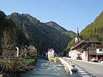
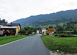
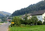
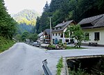
Smoleva (pronounced [smɔˈleːʋa]) is a village in the Municipality of Železniki in the Upper Carniola region of Slovenia. It lies in the valley of Lower Smoleva Creek (Slovene: Prednja Smoleva) between Špik Hill (882 meters or 2,894 feet) to the northeast and Mount Vancovec (1,085 meters or 3,560 feet) to the southwest.
Excerpt from the Wikipedia article Smoleva (License: CC BY-SA 3.0, Authors, Images).Smoleva
Geographical coordinates (GPS) Address Nearby Places Show on map
Geographical coordinates (GPS)
| Latitude | Longitude |
|---|---|
| N 46.211108333333 ° | E 14.165886111111 ° |
Address
4227
Slovenia
Open on Google Maps


