Feuerspitze
Lechtal AlpsMountains of Tyrol (state)Mountains of the AlpsTyrol geography stubs

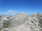
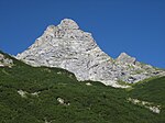
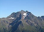
Feuerspitze ("Fire-Peak") is a mountain in the Lechtal Alps of Tyrol. The elevation at its peak is 2,852 metres (9,357 ft). Feuerspitze is located 7 kilometres (4.3 mi) southeast of Holzgau.
Excerpt from the Wikipedia article Feuerspitze (License: CC BY-SA 3.0, Authors, Images).Feuerspitze
Klämmle,
Geographical coordinates (GPS) Address Nearby Places Show on map
Geographical coordinates (GPS)
| Latitude | Longitude |
|---|---|
| N 47.2 ° | E 10.366666666667 ° |
Address
Klämmle
6655
Austria
Open on Google Maps


