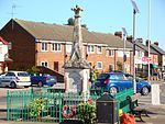
place

Lilley, Hertfordshire

Civil parishes in HertfordshireHertfordshire geography stubsVague or ambiguous time from May 2023Villages in Hertfordshire
Lilley The Church of St Peter's geograph.org.uk 202359

Lilley is a small village and civil parish situated between Hitchin and Luton in Hertfordshire, England. Lilley stands on high ground: nearby Telegraph Hill is just over 600 feet above sea level. The church, rebuilt in the 19th century, contains some original features and a fine Elizabethan heraldic memorial. According to tradition, Lilley was once the residence of John Kellerman, an alleged occultist described by Sir Richard Phillips as the "last of the alchemists."Lilley lies within the parliamentary constituency of Hitchin and Harpenden. Until recently it had two public houses, the Silver Lion and the Lilley Arms. The recent closure and conversion of the Silver Lion leaves the Lilley Arms as the village's only pub. The low-lying land to the south of Lilley is called Lilley Bottom. The Icknield Way Path passes the edge of the parish on its 110-mile course from Ivinghoe Beacon in Buckinghamshire to Knettishall Heath in Suffolk. The village has a football team, although they presently do not play in Lilley due to lack of facilities. The village cricket club is one of the oldest in Hertfordshire, with fixtures dating back to the mid-1890s. The cricket club plays at the Geoff Banks-Smith Memorial Cricket Ground, between St Peter's Church and the village hall and are currently in North Herts League Division 2. The church holds a flower festival every early May Bank Holiday weekend.

Excerpt from the Wikipedia article Lilley, Hertfordshire (License: CC BY-SA 3.0, Authors, Images).

Lilley, Hertfordshire
Lilley Bottom, North Hertfordshire

Geographical coordinates (GPS) Address Nearby Places
placeShow on map

Wikipedia: Lilley, HertfordshireContinue reading on Wikipedia

Geographical coordinates (GPS)

Latitude Longitude
N 51.922243 ° E -0.372468 °
placeShow on map

Address

West Street

Lilley Bottom
LU2 8NS North Hertfordshire
England, United Kingdom
mapOpen on Google Maps

Lilley The Church of St Peter's geograph.org.uk 202359
Share experience

Nearby Places

Deacon Hill SSSI
Deacon Hill SSSI

Deacon Hill SSSI is a 35.4-hectare (87-acre) biological Site of Special Scientific Interest in Pegsdon in Bedfordshire. It is in the Chilterns Area of Outstanding Natural Beauty, and it is part of the Pegsdon Hills and Hoo Bit nature reserve, managed by Wildlife Trust for Bedfordshire, Cambridgeshire and Northamptonshire.The site is calcareous grassland which is rich in plant species, some of which are uncommon. Birds include lapwings and buzzards, and there are butterflies such as dingy and grizzled skippers. There are also the remains of ancient strip lynchet fields.The SSSI covers part of Deacon Hill and part of the adjacent Pegsdon Hills. This is a remnant of semi-natural chalk downland and the calcareous soil supports a characteristic range of grasses and herbs. The main grasses present are sheep’s fescue, false oat-grass and upright brome. Forbs found here include spring sedge, autumn gentian, yellow-wort, fragrant orchid, common spotted-orchid, common milkwort, common rock-rose, cowslip, eyebright, clustered bellflower, harebell, carline thistle, wild thyme, marjoram and moschatel. There are also wild candytuft, field fleawort and pasque flower, all of which are rare in Bedfordshire.There is also some scrubland, the main trees being hawthorn, which often invades chalk downland, a buckthorn and wayfaring tree, with black bryony and old man's beard; false-brome usually dominates the ground flora in scrubby areas. There are glowworms, and grizzled skipper and dingy skipper butterflies.There is access to the site from Hitchin Road.