place

Pirton, Hertfordshire

Civil parishes in HertfordshireHertfordshire geography stubsVillages in Hertfordshire
Church of St. Mary, Pirton, north side geograph.org.uk 89386

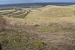
Pirton is a large village and civil parish three miles northwest of Hitchin in Hertfordshire, England. The population of the civil parish at the 2011 census was 1,274.The church, rebuilt in 1877, but with the remains of its 12th-century tower, is built within the bailey of a former castle, Toot Hill. Pirton Grange, which was remodelled in the 18th century, is in the north of the parish, and is a particularly interesting, moated Elizabethan house with a timber-framed gatehouse. Hammonds Farm and Rectory Farm, with its tithe barn, are also Elizabethan. Pirton first appeared in official records in the Domesday Book in 1086 within the hundred of Hitchin. The village was then known as Peritone (meaning 'Homestead of Pears')The Icknield Way Path passes through the village on its 110-mile (180 km) journey from Ivinghoe Beacon in Buckinghamshire to Knettishall Heath in Suffolk. The Icknield Way Trail, a multi-user route for walkers, horse riders and off-road cyclists also passes through the village. There are two churches in Pirton - one Methodist, one Anglican. There is a village school which teaches children from reception to Year 6. Many students continue on at Hitchin Priory. There are two local pubs - the Motte and Bailey on Great Green, and the Fox on High Street. Pirton has both football and cricket clubs.

Excerpt from the Wikipedia article Pirton, Hertfordshire (License: CC BY-SA 3.0, Authors, Images).

Pirton, Hertfordshire
Colemans Close, North Hertfordshire

Geographical coordinates (GPS) Address Nearby Places
placeShow on map

Wikipedia: Pirton, HertfordshireContinue reading on Wikipedia

Geographical coordinates (GPS)

Latitude Longitude
N 51.97277 ° E -0.33148 °
placeShow on map

Address

Colemans Close

Colemans Close
SG5 3FJ North Hertfordshire
England, United Kingdom
mapOpen on Google Maps

Church of St. Mary, Pirton, north side geograph.org.uk 89386
Share experience

Nearby Places

Deacon Hill SSSI
Deacon Hill SSSI

Deacon Hill SSSI is a 35.4-hectare (87-acre) biological Site of Special Scientific Interest in Pegsdon in Bedfordshire. It is in the Chilterns Area of Outstanding Natural Beauty, and it is part of the Pegsdon Hills and Hoo Bit nature reserve, managed by Wildlife Trust for Bedfordshire, Cambridgeshire and Northamptonshire.The site is calcareous grassland which is rich in plant species, some of which are uncommon. Birds include lapwings and buzzards, and there are butterflies such as dingy and grizzled skippers. There are also the remains of ancient strip lynchet fields.The SSSI covers part of Deacon Hill and part of the adjacent Pegsdon Hills. This is a remnant of semi-natural chalk downland and the calcareous soil supports a characteristic range of grasses and herbs. The main grasses present are sheep’s fescue, false oat-grass and upright brome. Forbs found here include spring sedge, autumn gentian, yellow-wort, fragrant orchid, common spotted-orchid, common milkwort, common rock-rose, cowslip, eyebright, clustered bellflower, harebell, carline thistle, wild thyme, marjoram and moschatel. There are also wild candytuft, field fleawort and pasque flower, all of which are rare in Bedfordshire.There is also some scrubland, the main trees being hawthorn, which often invades chalk downland, a buckthorn and wayfaring tree, with black bryony and old man's beard; false-brome usually dominates the ground flora in scrubby areas. There are glowworms, and grizzled skipper and dingy skipper butterflies.There is access to the site from Hitchin Road.