place

Old Town, Staten Island

1661 establishments in North America1661 establishments in the Dutch EmpireEstablishments in New NetherlandNeighborhoods in Staten IslandPopulated places established in 1661
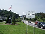
Old Town SI welcome jeh

Old Town is a neighborhood in the New York City borough of Staten Island, located on its East Shore. Old Town was established in August 1661 as part of New Netherland, and was the first permanent European settlement on Staten Island. Originally described as "Oude Dorpe" (old village in Dutch), much of its original territory makes up what is present-day South Beach, with parts of Midland Beach and Dongan Hills. The area was settled by a group of Dutch, Walloon (from what is now southern Belgium and its borders with France) and French Protestants (Huguenots) led by Walloon Pierre Billiou. Present-day Old Town is typically described as the neighborhood bordered by Grasmere to the north, Dongan Hills to the south, South Beach to the east, and Concord to the west. The neighborhood is served by the Old Town station of the Staten Island Railway. Old Town is also served by the S78 and S79 SBS local buses on Hylan Boulevard and the S74, S84, S76 and S86 local buses on Richmond Road. Express bus service is provided by the SIM1 and SIM5 on Hylan Boulevard and the SIM15 on Richmond Road.

Excerpt from the Wikipedia article Old Town, Staten Island (License: CC BY-SA 3.0, Authors, Images).

Old Town, Staten Island
Hylan Boulevard, New York Staten Island

Geographical coordinates (GPS) Address Nearby Places
placeShow on map

Wikipedia: Old Town, Staten IslandContinue reading on Wikipedia

Geographical coordinates (GPS)

Latitude Longitude
N 40.595833333333 ° E -74.085833333333 °
placeShow on map

Address

Hylan Boulevard

Hylan Boulevard
10305 New York, Staten Island
New York, United States
mapOpen on Google Maps

Old Town SI welcome jeh
Share experience

Nearby Places

Concord, Staten Island

Concord is a neighborhood located in the borough of Staten Island in New York City, New York, United States. Located in northeastern Staten Island, and bordered by the neighborhoods of Grasmere, Clifton, Dongan Hills, Emerson Hill, and Old Town, Concord was named Dutch Farms originally, but was renamed in 1845 after Concord, Massachusetts as a consequence of that town's historical significance. Early residents of Concord included Judge William Emerson (brother of Ralph Waldo Emerson and for whom nearby Emerson Hill is named) and Henry David Thoreau. In the early 19th Century, Concord had a dominant German immigrant population. Today, it is ethnically diverse.Concord currently consists of one-family homes, small apartment buildings, and condominiums. The neighborhood's center is traversed by some of the most heavily traveled roads on Staten Island, including Clove Road; Richmond Road; Targee Street; and the Staten Island Expressway. Much property in Concord was condemned to make way for the Staten Island Expressway in the early 1960s; a principal east–west thoroughfare. Price Street is now a service road of the expressway and is known as Narrows Road North. In its first year of existence — 1961-62 — Monsignor Farrell High School used an annex of St. Sylvester's Elementary School in Concord while the construction of its permanent campus in Oakwood was being completed. In 1985, Staten Island's first mosque opened in Concord; it later moved to Tompkinsville, however. A small public alternative high school, named Concord High School, is located in the neighborhood, which is also home to a large medical arts complex (on Ralph Place) that had sprung up around the former Doctor's Hospital of Staten Island, which closed in 2003.