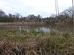
Chipping Warden

Chipping Warden is a village and former civil parish, now in the parish of Chipping Warden and Edgcote, in the West Northamptonshire district, in the ceremonial county of Northamptonshire, England, about 6 miles (10 km) northeast of the Oxfordshire town of Banbury. The parish is bounded to the east and south by the River Cherwell, to the west by the boundary with Oxfordshire and to the north by field boundaries. On 1 October 2008 the parish was abolished and merged with Edgcote to form "Chipping Warden & Edgcote".The 2001 Census recorded a parish population of 529 in 234 households, increasing to 537 in the civil parish of Chipping Warden and Edgcote at the 2011 census.
Excerpt from the Wikipedia article Chipping Warden (License: CC BY-SA 3.0, Authors, Images).Chipping Warden
Byfield Road,
Geographical coordinates (GPS) Address Nearby Places Show on map
Geographical coordinates (GPS)
| Latitude | Longitude |
|---|---|
| N 52.136 ° | E -1.272 ° |
Address
Byfield Road
Byfield Road
OX17 1LE , Chipping Warden and Edgcote
England, United Kingdom
Open on Google Maps


