Batona Trail

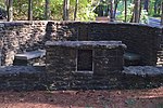
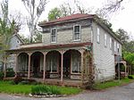
The Batona Trail is a 53.5-mile (86.1 km) hiking trail through New Jersey's Pine Barrens. The trail is one of the longest in the state, behind the Delaware and Raritan Canal Trail, the section of the Appalachian Trail within the state, the Liberty-Water Gap Trail, and the completed section of the Highlands Trail in the state. The Batona Trail begins in Brendan T. Byrne State Forest (formerly Lebanon State Forest) at the ghost town of Ong's Hat and traverses Franklin Parker Preserve, Wharton State Forest and Bass River State Forest. The trail was built in 1961 by the Batona Hiking Club, which began informally in 1928 when Philadelphians began meeting regularly to hike. It takes about three days to hike the whole trail.
Excerpt from the Wikipedia article Batona Trail (License: CC BY-SA 3.0, Authors, Images).Batona Trail
Seaf Weeks Road,
Geographical coordinates (GPS) Address Nearby Places Show on map
Geographical coordinates (GPS)
| Latitude | Longitude |
|---|---|
| N 39.621 ° | E -74.543 ° |
Address
Seaf Weeks Road
Seaf Weeks Road
New Jersey, United States
Open on Google Maps


