place

Wading River (New Jersey)

Burlington County, New Jersey, geography stubsNew Jersey river stubsRivers in the Pine Barrens (New Jersey)Rivers of Burlington County, New JerseyRivers of New Jersey
Tributaries of the Mullica River

The Wading River is a tributary of the Mullica River, approximately 10.1 miles (16.3 km) long, in southern New Jersey in the United States. The river drains a rural forested area of the Pinelands, one of the most pristine areas along the coast of the northeastern United States.

Excerpt from the Wikipedia article Wading River (New Jersey) (License: CC BY-SA 3.0, Authors).

Wading River (New Jersey)
Leektown Road,

Geographical coordinates (GPS) Address Nearby Places
placeShow on map

Wikipedia: Wading River (New Jersey)Continue reading on Wikipedia

Geographical coordinates (GPS)

Latitude Longitude
N 39.619576 ° E -74.492439 °
placeShow on map

Address

Leektown Road

Leektown Road
08215
New Jersey, United States
mapOpen on Google Maps

Share experience

Nearby Places

Bass River Township School District

The Bass River Township School District is a non-operating public school district that serves students from Bass River Township, in Burlington County, New Jersey, United States.Based on the results of a study performed by the Southern Regional Institute and Educational Technology Training Center of Stockton University, and in the wake of declining enrollment and rising costs, the district decided tp send all of its PreK-6 students to the Little Egg Harbor Township School District, starting in the 2020-21 school year. The board of education will oversee what becomes a non-operating district.As of the 2018–19 school year, the district, comprising one school, had an enrollment of 106 students and 12.8 classroom teachers (on an FTE basis), for a student–teacher ratio of 8.3:1. In the 2016–17 school year, Bass River had the 10th-smallest enrollment of any school district in the state, with 102 students.The district is classified by the New Jersey Department of Education as being in District Factor Group "CD", the sixth-highest of eight groupings. District Factor Groups organize districts statewide to allow comparison by common socioeconomic characteristics of the local districts. From lowest socioeconomic status to highest, the categories are A, B, CD, DE, FG, GH, I and J.Students in seventh through twelfth grades attend the schools of the Pinelands Regional School District, which also serves students from Eagleswood Township, Little Egg Harbor Township and Tuckerton Borough. Schools in the district (with 2018–19 enrollment data from the National Center for Education Statistics) are Pinelands Regional Junior High School with 811 students in grades 7-9 and Pinelands Regional High School with 744 students in grades 10–12. The district's board of education includes nine members directly elected by the residents of the constituent municipalities to three-year terms on a staggered basis, with three seats up for election each year. Bass River Township is allocated one of the nine seats.

Harrisville, New Jersey

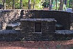
Harrisville (also called Harrisia or McCartyville) is an unincorporated community and ghost town located about 6 miles (9.7 km) northwest of New Gretna within Bass River Township in Burlington County, in the U.S. state of New Jersey, in the New Jersey Pine Barrens. The first industry at the site of Harrisville appears to have been a sawmill built by Evi Belangee no later than 1760. Near the mouth of the Oswego River, where its floodplain narrowed, he built a dam with 5 or 6 feet of head to run his mill.: 1918  The dam was enlarged in 1795, when a slitting mill, for cutting iron sheet into strips for nailmaking, was built at the site by Isaac Potts.: 1918 : 71  Potts had recently built Martha Furnace upstream, and when he sold the latter in 1796, he noted that its pig iron would have a natural market at the slitting mill.: 85  This business was not very successful, and about 1815 it was converted to a paper plant, powered by water brought by a canal from a dam on the Oswego, a tributary of the Wading River. The town which was built around the factory was originally called McCartyville after the factory owner; when the Harris family bought the factory in 1855, the name was changed to Harrisville. Under the Harris family, Harrisville was a company town, with a grist mill, post office, company store, and free tenant homes for the workers of the paper mill. In 1914, a fire started in Harrisville and destroyed the entire town, leaving only ruins. Only the decayed ruins of this town exist today.