place

Pomonok Country Club

1886 establishments in New York (state)1949 disestablishments in New York (state)Defunct sports clubs in the United StatesGolf club and course stubsGolf clubs and courses designed by Devereux Emmet
Golf clubs and courses in New York (state)Queens, New York building and structure stubsSports venues in Queens, New York

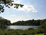
Pomonok Country Club was a country club in the northeastern United States, located in what is now the Pomonok neighborhood of the New York City borough of Queens. The golf course was located between Kissena Boulevard and 164th Street, just to the south of Horace Harding Boulevard (now the Long Island Expressway) and to the east of Queens College.The club was established in 1886 by members of the Flushing Athletic Club in southern Flushing and moved to the Kissena Boulevard location in 1921. Devereux Emmet designed the golf course; the members disbanded and sold the course in 1949. Part of the site today contains the Electchester cooperative housing development, Pomonok public housing, and an extension of Parsons Boulevard.The golf course hosted the PGA Championship in 1939, in which Henry Picard defeated Byron Nelson in the final in 37 holes. The match play event was held in July during the New York World's Fair, which was located at Flushing Meadows–Corona Park, approximately two miles (3 km) northwest. The former course of Fresh Meadow Country Club was a few miles east (40.733°N 73.78°W / 40.733; -73.78); it hosted the PGA Championship in 1930 and the U.S. Open in 1932. That course was sold in 1946 for development and the club moved to Lake Success, five miles (8 km) northeast.

Excerpt from the Wikipedia article Pomonok Country Club (License: CC BY-SA 3.0, Authors).

Pomonok Country Club
Parsons Boulevard, New York Queens

Geographical coordinates (GPS) Address Nearby Places
placeShow on map

Wikipedia: Pomonok Country ClubContinue reading on Wikipedia

Geographical coordinates (GPS)

Latitude Longitude
N 40.734 ° E -73.81 °
placeShow on map

Address

Parsons Boulevard 67-11
11365 New York, Queens
New York, United States
mapOpen on Google Maps

Share experience

Nearby Places

Playground Seventy Five

Playground Seventy Five is a public park located on 160th Street and 75th Avenue in the Hillcrest neighborhood of Queens, New York. It was acquired by the New York City government in 1929 as part of land condemnations for the construction of Public School 154. The undeveloped section of the block was reserved as a schoolyard and developed as a playground in 1954. The playground was named after 75th Avenue, a historical thoroughfare known as Quarrelsome Lane that dates to the 19th century when the surrounding landscape consisted of farmland. In 1911, Queens Borough President Maurice E. Connolly directed the borough's Topographical Bureau to design a numbered grid system to connect road segments across Queens and eliminate duplicate names. Quarrelsome Lane became 75th Avenue and nearby Black Stump Road, named after the stumps that delineated farm boundaries, became 73rd Avenue.The section of Fresh Meadows surrounding this playground was historically known as Flushing Suburban was developed in the 1920s and experienced an influx of African Americans in the 1950s. In contrast to many other racially changing neighborhoods, Flushing Suburban maintained its diversity throughout the following decades. Following the 1964 expansion of the Public School 154, the remaining portion of the playground was jointly operated by Parks and the Board of Education.Through the efforts of Flushing Suburban Civic Association, residents participated in the civil rights movement by protesting instances of discrimination in Queens while also traveling to the South to promote voter registration. Since 1990, the group organized volunteer cleanups of Playground 75, along with sports programs in partnership with P.S. 154 and other neighborhood schools.

Vleigh Playground

Vleigh Playground is a 2.243-acre park in Kew Gardens Hills, Queens, New York City. It takes its name from Head of the Vleigh Road, a colonial period path that ran along the northern boundary of the playground site. This path is presently followed by Vleigh Place and 70th Road. This road connected the town of Flushing to Brooklyn during colonial times, allowing travelers to circumvent Flushing Meadows, then an impassible swamp. Its name is derived from the Dutch word vlaie (also spelled vlie, meaning "swamp" or "valley") in reference to Flushing Meadows. Prior to the mid-20th century, much of Kew Gardens Hills was farmland owned by the Campbell, Jackson and Miller families. In the early 20th century, some of the farms were purchased by the Arrowbrook and Pomonok golf clubs that capitalized on the hilly terrain and scenic views. With the extension of the Independent Subway System's Queens Boulevard line to Kew Gardens–Union Turnpike station in 1936, which promised a 20-minute ride into Manhattan, Kew Gardens Hills became more attractive to developers. Entrepreneur Abraham Wolosoff purchased land in the area hoping to use its hills and rural setting to attract residents. The developer gave the neighborhood its current name, Kew Gardens Hills, after the nearby Kew Gardens neighborhood. With residential construction increasing following the Second World War, there was demand for a new school in Kew Gardens Hills. Recognizing the quickening loss of open space, the City’s Board of Estimate voted to acquire this remaining undeveloped parcel for a school and playground. The city acquired the land for this playground in 1949 through condemnation. It opened in on January 15, 1952 as the PS 165 Playground.The adjacent school, PS 165 is co-named after Edith K. Bergtraum (1918-1994) a teacher and member of the New York City Commission on the Status of Women. Her husband Murry Bergtraum. Murry Bergtraum served as president of the New York City Board of Education from 1969 until his death in 1973. The co-naming was sponsored by Rep. Gary Ackerman in 1995.Surrounded by the apartment complexes of Dara Gardens, Georgetown Mews and Pomonok Houses, the Vleigh Playground offers much needed playing space for the neighborhood’s children.

Kissena Park
Kissena Park

Kissena Park is a 235-acre (95 ha) park located in the neighborhood of Flushing in Queens, New York City. It is located along the subterranean Kissena Creek, which flows into the Flushing River. It is bordered on the west by Kissena Boulevard; on the north by Rose, Oak, Underhill, and Lithonia Avenues; on the east by Fresh Meadow Lane; and on the south by Booth Memorial Avenue. The park contains the city's only remaining velodrome, a lake of the same name, two war memorials, and various playgrounds and sports fields. The site of Kissena Park was originally part of a tree nursery operated by Samuel Parsons in the late 19th century, though parts of the park were also the site of a Long Island Rail Road line. The lake on Parsons's property was named "Kissena", which comes from the Chippewa language meaning "it is cold", "cold place", or "cool water", and the park was later named after the lake. After Parsons died in 1906, part of his former nursery was incorporated in the modern-day park. The name "Kissena Park" can also refer to a residential section of Flushing just north of the park. Kissena Park opened in 1910, and it was incorporated into Kissena Corridor Park in the mid-1950s. Various improvement projects have been conducted during Kissena Park's history, including the addition of the velodrome in 1962 and restorations of the lake in 1942 and 1983. Subsequently, the Kissena Velodrome was restored and rededicated in 2004, and a Korean War memorial was dedicated in 2007.