Sugarloaf Mountain (Maryland)

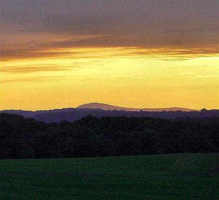
Sugarloaf Mountain is a small (1,283 foot; 391 m) mountain and park about 10 miles (16 km) south of Frederick, Maryland, USA. The closest village is Barnesville, located just over one mile from the foot of the mountain. The peak of this relatively low mountain is approximately 800 feet (244 m) higher than the surrounding farmland. It is visible from many parts of northern Montgomery County and southern Frederick County, notably from I-270 north of the town of Germantown. Because of its geological and natural history interest, it was designated a National Natural Landmark in 1969. It is a notable example of an admission-free (although donations are requested), privately owned scenic park.
Excerpt from the Wikipedia article Sugarloaf Mountain (Maryland) (License: CC BY-SA 3.0, Authors, Images).Sugarloaf Mountain (Maryland)
Comus Road,
Geographical coordinates (GPS) Address Phone number Website External links Nearby Places Show on map
Geographical coordinates (GPS)
| Latitude | Longitude |
|---|---|
| N 39.269208333333 ° | E -77.395247222222 ° |
Address
Sugarloaf Mountain
Comus Road 7901
20842
Maryland, United States
Open on Google Maps


