place

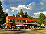
Carnelian Bay, California

Census-designated places in Placer County, CaliforniaLake TahoePopulated places in the Sierra Nevada (United States)
Placer County California Incorporated and Unincorporated areas Carnelian Bay Highlighted 0611418

Carnelian Bay (formerly, Cornelian Bay) is an unincorporated community on the shore of Lake Tahoe in Placer County, California, United States. The Cornelian Bay post office operated from 1883 to 1887 and from 1891 to 1893. The Carnelian Bay post office opened in 1908.For statistical purposes, the United States Census Bureau has defined Carnelian Bay as a census-designated place (CDP). The census definition of the area may not precisely correspond to local understanding of the area with the same name. The population was 524 at the 2010 census. The elevation is 6,325 feet (1,928 m). Nearby cities and towns include: Tahoe Vista, Brockway, Kings Beach, Crystal Bay, Incline Village, Truckee, Tahoma, Homewood, and Tahoe City. Its ZIP code is 96140 and its area code 530.

Excerpt from the Wikipedia article Carnelian Bay, California (License: CC BY-SA 3.0, Authors, Images).

Carnelian Bay, California
Silver Pine Drive,

Geographical coordinates (GPS) Address Nearby Places
placeShow on map

Wikipedia: Carnelian Bay, CaliforniaContinue reading on Wikipedia

Geographical coordinates (GPS)

Latitude Longitude
N 39.232777777778 ° E -120.08166666667 °
placeShow on map

Address

Silver Pine Drive

Silver Pine Drive
96148
California, United States
mapOpen on Google Maps

Placer County California Incorporated and Unincorporated areas Carnelian Bay Highlighted 0611418
Share experience

Nearby Places

Brockway, California

Brockway (formerly, Hot Springs) is an unincorporated community in Placer County, California. Brockway is located on the north shore of Lake Tahoe on State Line Point, adjacent to the Nevada state border. It lies at an elevation of 6266 feet (1910 m).The Brockway post office operated from 1901 to 1966. The name honors Nathaniel Brockway, uncle of the first postmaster.Brockway was one of the first places settled at Lake Tahoe by American immigrants to California after the first Trans-Continental Railroad, which passed 12 miles north of the lake, through Truckee. The first road built to transport tourists from the Truckee railstop to Lake Tahoe was over Brockway summit (Highway 267), and ended at the Brockway pier, where steamers could take visitors to other locations. Soon afterwards, a spur railroad was built to Tahoe City from Truckee, and it became the first real resort community at the lake. (The old railroad grade is now a bicycle path along the Truckee River.) Brockway has the only hot springs at Lake Tahoe, right at the shore. Old "grain grinding holes" (Washo: gámuŋ ) are visible in massive talus boulders along the shore. A "commodious" hotel was constructed around 1869, shortly after the completion of the road over Brockway Summit. Brockway was once located in two different states as surveyors establishing the California-Nevada border (which makes its turn to the north in the middle of the lake) mistakenly placed the line a half mile west of its proper location, placing Brockway in Nevada. It was eventually corrected. The Brockway community grew and numerous homes were built in the 1920s and 30s. In the 1930s and 40s, Brockway attracted Hollywood celebrities.