place

Charles J. Martin House

Houses completed in 1903Houses in MinneapolisHouses on the National Register of Historic Places in MinnesotaNational Register of Historic Places in MinneapolisRenaissance Revival architecture in Minnesota
Charles J. Martin House

The Charles J. Martin House is a house in the Lowry Hill neighborhood of Minneapolis, Minnesota, United States. The 1903 Renaissance Revival mansion and its grounds are a well-preserved example of an early-20th-century urban estate. The property was listed on the National Register of Historic Places in 1978 for having local significance in architecture.The house was built for Charles J. Martin. He served for many years as the secretary and treasurer of the Washburn-Crosby Company, a predecessor of General Mills. Martin also promoted civic causes such as city parks, libraries, and art societies.The house was designed by prominent Minneapolis architect William Channing Whitney in the Renaissance Revival style, which was popular for large urban residences at the beginning of the 20th century. The house has been well preserved and well maintained.

Excerpt from the Wikipedia article Charles J. Martin House (License: CC BY-SA 3.0, Authors, Images).

Charles J. Martin House
Mount Curve Avenue, Minneapolis Bde Maka Ska - Isles

Geographical coordinates (GPS) Address Nearby Places
placeShow on map

Wikipedia: Charles J. Martin HouseContinue reading on Wikipedia

Geographical coordinates (GPS)

Latitude Longitude
N 44.967777777778 ° E -93.296 °
placeShow on map

Address

Mount Curve Avenue 1300
55403 Minneapolis, Bde Maka Ska - Isles
Minnesota, United States
mapOpen on Google Maps

Charles J. Martin House
Share experience

Nearby Places

Lowry Hill, Minneapolis

Lowry Hill is a neighborhood within the Calhoun-Isles community in Minneapolis, Minnesota. The neighborhood is regarded as being one of the city’s most upscale and wealthy neighborhoods. It was historically the home of Minneapolis’s most prominent milling and lumber families.The neighborhood is named for the terminal moraine on which it sits, a hill named after late nineteenth century real estate mogul and trolley tycoon Thomas Lowry. Although secluded by trees and parkways up on the hill, its boundaries are Interstate 394 to the north, Interstate 94 to the east, Hennepin Avenue to the southeast, West 22nd Street to the south, Lake of the Isles Parkway to the southwest, and Logan Avenue South and Morgan Avenue South to the west. Lowry Hill is northwest of Lowry Hill East; the two neighborhoods are separated by Hennepin Avenue. The hill was described as swampy and covered in a thick old-growth forest during Minneapolis’s early years. The hill eventually became a small farming area overlooking Minneapolis in the mid 1800s.Many houses in Lowry Hill were built in the Victorian style before 1900. However, the Colonial, Mediterranean, English Tudor, Richardsonian Romanesque, Rambler, and Prairie style make appearances as well. A majority of those homes were constructed shortly after the neighborhood's establishment as a preferred residential area for many of the wealthiest of Minneapolis' citizens. In over 100 years, the look of Lowry Hill has remained almost unchanged, however, some of the large homes built by original owners have been converted to condominia.

Minneapolis Sculpture Garden

The Minneapolis Sculpture Garden is an 11-acre (4.5 ha) park in Minneapolis, Minnesota, in the United States. It is located near the Walker Art Center, which operates it in coordination with the Minneapolis Park and Recreation Board. It reopened June 10, 2017 after a reconstruction that resulted with the Walker and Sculpture Garden being unified as one 19-acre campus. It is one of the largest urban sculpture gardens in the country, with 40 permanent art installations and several other temporary pieces that are moved in and out periodically.The park is located to the west of Loring Park and the Basilica of Saint Mary. The land was first purchased by the park board around the start of the 20th century, when it was known as "The Parade" because it had been used for military drills. It became known as the Armory Gardens after park superintendent Theodore Wirth created a formal design that included a U.S. National Guard armory (Kenwood Armory) for Spanish War volunteers. Working as a civic and cultural center, in 1913 a floral convention transformed the land into floral gardens, which it remained for the next 50 years. In 1934, six years after the Walker Art Gallery opened across the street, the Armory was demolished for its instability, and a new Armory built in downtown Minneapolis, turning the Armory Gardens over to the Minneapolis Park Board. Since 1908 the area of today's Sculpture Garden and land to the west had been used for sport recreation via mildly-improved playing fields and the 1950 construction of the original Parade Stadium. In 1988, the Minneapolis Sculpture Garden opened, designed by Edward Larrabee Barnes and landscape architects Quinnel and Rothschild. Parade Stadium was demolished in 1990, two years later the Garden was expanded, adding 3.5 acres (1.4 ha). Michael Van Valkenburgh and Associates, Inc. designed the northward extension to complement the original space with a more open area that features a walkway and the 300-foot-long (91 m) Alene Grossman Memorial Arbor. The centerpiece of the garden is the Spoonbridge and Cherry (1985–1988) fountain designed by husband and wife Claes Oldenburg and Coosje van Bruggen.A pedestrian bridge, the Irene Hixon Whitney Bridge (1987), designed by Siah Armajani, now crosses Hennepin Avenue, connecting the sculpture garden to Loring Park.

Lowry Hill Tunnel
Lowry Hill Tunnel

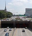
The Lowry Hill Tunnel is a tunnel approximately 1500 ft in length accommodating the Interstate 94 (I-94) freeway near downtown Minneapolis, Minnesota that was completed in late 1971. It is placed at a near-right-angle turn in the highway, forcing the three lanes of traffic in each direction to slow down. The advised speed is 40 miles per hour (64 km/h). Although constructed as a tunnel through rock, the surface a few yards above is covered with roadways. The tunnel functions as if it were the underpass under a 0.25-mile-wide (400 m) bridge which carries Hennepin Avenue, Lyndale Avenue, and various ramps over I-94. It is a bottleneck due to its dog-leg turn, and various proposals have been made for dealing with it. In May 2005, one city engineer proposed restriping it to four lanes in each direction. This would not help the slowdown, but would theoretically allow more cars through it at a given time. The tunnel is also a leading contender for a new high-occupancy toll lane using the MnPASS electronic toll collection system. Some believe that Interstate 335, a proposed but never-built freeway north of downtown between I-94 and Interstate 35W, would have alleviated the traffic problems in the tunnel. However, others have noted that the highway would not have benefited many drivers, particularly since the nearby interchange between I-35W and I-94 is missing certain links. There is no connection to carry southbound I-35W traffic to eastbound I-94, or westbound I-94 traffic to northbound I-35W, both of which would have been important flows if I-335 were to be successful. Opened in November 1971, this tunnel was built with $31 million dollars to help fix the congestion of 30,000 vehicles a day. Today, the Lowry Hill Tunnel sees an average of 185,000 vehicles pass through it each day making it one of the worlds busiest tunnels - if not the busiest. For comparison, that is 54% more vehicles than those passing through the Lincoln Tunnel that connects New Jersey to Manhattan.