place

Boehm House

Historic Richmond TownHouses completed in 1750Houses in Staten IslandNew York City Designated Landmarks in Staten IslandRelocated buildings and structures in New York City
Richmondtown, Staten IslandStaten Island building and structure stubs
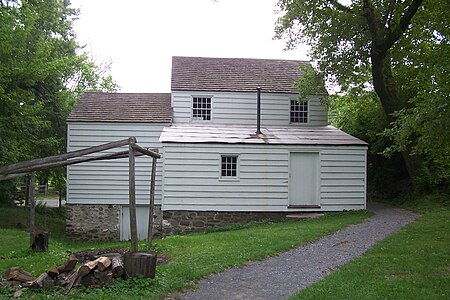
Boehmhouseback
Boehmhouseback

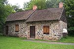
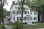
The Boehm House is an historic house at 75 Arthur Kill Road in the Richmondtown section of the borough of Staten Island in New York City. This 1750 house, relocated from Greenridge as a part of Historic Richmondtown, was typical of rural New York during the American Revolution. Also on view in the house: an exhibit of early building techniques and restorations. It was designated a New York City landmark in 1969 as the "Boehm-Frost House".

Excerpt from the Wikipedia article Boehm House (License: CC BY-SA 3.0, Authors, Images).

Boehm House
Arthur Kill Road, New York Staten Island

Geographical coordinates (GPS) Address Nearby Places
placeShow on map

Wikipedia: Boehm HouseContinue reading on Wikipedia

Geographical coordinates (GPS)

Latitude Longitude
N 40.571694444444 ° E -74.147305555556 °
placeShow on map

Address

Boehm House

Arthur Kill Road
10308 New York, Staten Island
New York, United States
mapOpen on Google Maps

Boehmhouseback
Boehmhouseback
Share experience

Nearby Places

Staten Island
Staten Island

Staten Island ( STAT-ən) is the southernmost borough of New York City, coextensive with Richmond County and situated at the southern tip of the U.S. state of New York. The borough is separated from the adjacent state of New Jersey by the Arthur Kill and the Kill Van Kull and from the rest of New York by New York Bay. With a population of 495,747 in the 2020 Census, Staten Island is the least populated New York City borough but the third largest in land area at 58.5 sq mi (152 km2); it is also the least densely populated and most suburban borough in the city. A home to the Lenape indigenous people, the island was settled by Dutch colonists in the 17th century. It was one of the 12 original counties of New York state. Staten Island was consolidated with New York City in 1898. It was formerly known as the Borough of Richmond until 1975, when its name was changed to Borough of Staten Island. Staten Island has sometimes been called "the forgotten borough" by inhabitants who feel neglected by the city government.The North Shore—especially the neighborhoods of St. George, Tompkinsville, Clifton, and Stapleton—is the island's most urban area. It contains the designated St. George Historic District and the St. Paul's Avenue-Stapleton Heights Historic District, which feature large Victorian houses. The East Shore is home to the 2+1⁄2-mile (4-kilometer) FDR Boardwalk, the world's fourth-longest boardwalk. The South Shore, site of the 17th-century Dutch and French Huguenot settlement, developed rapidly beginning in the 1960s and 1970s and is now mostly suburban. The West Shore is the island's least populated and most industrial part. Motor traffic can reach the borough from Brooklyn by the Verrazzano-Narrows Bridge and from New Jersey by the Outerbridge Crossing, Goethals Bridge and Bayonne Bridge. Staten Island has Metropolitan Transportation Authority (MTA) bus lines and an MTA rapid transit line, the Staten Island Railway, which runs from the ferry terminal at St. George to Tottenville. Staten Island is the only borough not connected to the New York City Subway system. The free Staten Island Ferry connects the borough to Manhattan across New York Harbor. It provides views of the Statue of Liberty, Ellis Island, and Lower Manhattan.