Lookout Point Lake

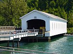
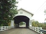
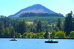
Lookout Point Lake (also Lookout Point Reservoir) is a large reservoir on the Middle Fork Willamette River in Lane County, Oregon, United States. It was created in 1953 with the construction of Lookout Point Dam.The downstream end of the reservoir is about 20 miles (32 km) southeast of Eugene. It lies immediately upriver from Dexter Lake, another reservoir. The city of Lowell is nearby, along the north shore of Dexter Lake. Oregon Route 58 follows the lake's southern shore and Boundary Road the northern shore. The lake, about 14 miles (23 km) long, continues upriver to within about 7 miles (11 km) of Oakridge.Lookout Point Dam, 276 feet (84 m) high, impounds up to 477,700 acre-feet (589,200,000 m3) of water. It helps control flooding, generates electricity, and provides a place for boating and other outdoor recreation.
Excerpt from the Wikipedia article Lookout Point Lake (License: CC BY-SA 3.0, Authors, Images).Lookout Point Lake
Geographical coordinates (GPS) Address Nearby Places Show on map
 Continue reading on Wikipedia
 Geographical coordinates (GPS)
| Latitude | Longitude |
|---|---|
| N 43.896666666667 ° | E -122.72611111111 ° |
Address
Lane County
Oregon, United States
Open on Google Maps