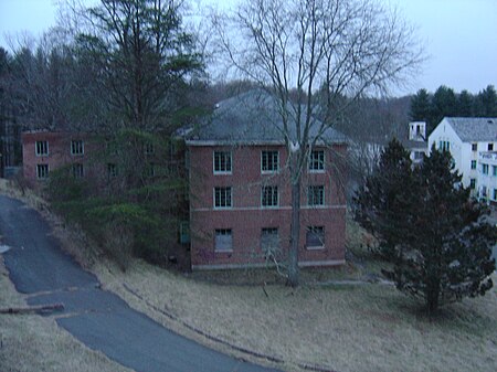
Henryton State Hospital

Henryton State Hospital is a now-demolished hospital complex in Marriottsville, in southern Carroll County, Maryland, just across the Howard County line. The complex was located within Patapsco Valley State Park and along its southern end runs CSX's Old Main Line Subdivision and is very close to the Henryton Tunnel. The Henryton State Hospital center, or the Henryton Tuberculosis Sanatorium as it was called, was erected in 1922 by the Maryland Board of Mental Hygiene. It was established as a facility to treat African Americans suffering from tuberculosis. This was one of the first such facilities in Maryland erected to provide African Americans with the same level of treatment as white people. Other accounts state that this was more of containment Hospital rather than a treatment facility. They contend that Henryton was used more for the exile and quarantine of tuberculosis patients. The original complex opened in 1922 and consisted of six main buildings and one utility plant. These buildings were erected between the years of 1921 and 1923. The establishment of the Henryton Sanatorium was one of the final steps in Maryland's program to treat all of the state's tubercular patients. In the late twenties and early thirties the tuberculosis rate among African Americans in Maryland was quadruple the rate among whites. This placed a heavy burden on the hospital to deal with the increasing number of patients. In 1938 the hospital was budgeted $270,000 for the construction of new buildings to house 200 more patients. A refrigerated morgue was demanded after the hospital cremated and disposed of the remains of an African American child before the parents were contacted. The new buildings roughly doubled the size of the overall facility, and several more municipal buildings added even more space to the complex. However, by the time the new buildings were completed in 1946, the tuberculosis rates had dropped, leaving much more room than was necessary.
Excerpt from the Wikipedia article Henryton State Hospital (License: CC BY-SA 3.0, Authors, Images).Henryton State Hospital
Henryton Hospital Road,
Geographical coordinates (GPS) Address Nearby Places Show on map
Geographical coordinates (GPS)
| Latitude | Longitude |
|---|---|
| N 39.353916666667 ° | E -76.915388888889 ° |
Address
Henryton Hospital Road
Henryton Hospital Road
21104
Maryland, United States
Open on Google Maps


