Langezwaag
Friesland geography stubsGeography of OpsterlandPopulated places in Friesland

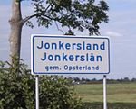
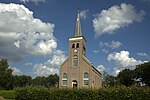
Langezwaag (West Frisian: Langsweagen) is a village in the municipality of Opsterland in the east of Friesland, the Netherlands. It had a population of around 1,365 in January 2017.The village was first mentioned in 1315 as Utresuagh, and means "long meadow with caddle". Lange (long) has been added to distinguish from Kortezwaag. Kortezwaag was annexed by Gorredijk in 1962 and is now a neighbourhood. The Dutch Reformed church was built in 1781 as a replacement of a medieval church. Langezwaag was home to 956 people in 1840.
Excerpt from the Wikipedia article Langezwaag (License: CC BY-SA 3.0, Authors, Images).Langezwaag
De Klamp, Opsterland
Geographical coordinates (GPS) Address Nearby Places Show on map
Geographical coordinates (GPS)
| Latitude | Longitude |
|---|---|
| N 52.983055555556 ° | E 6.0044444444444 ° |
Address
De Klamp 31
8404 GK Opsterland
Frisia, Netherlands
Open on Google Maps


