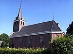
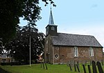
Luxwoude
Friesland geography stubsGeography of OpsterlandPopulated places in Friesland

Luxwoude (West Frisian: Lúkswâld) is a village in the municipality of Opsterland in the east of Friesland, the Netherlands. It had a population of around 275 in January 2017.The village was first mentioned in 1315 as Lukeswalde, and means the forest of Lucas (person). See also: Lucaswolde. Luxwoude developed as a peat excavation village. It was home to 137 people in 1840.
Excerpt from the Wikipedia article Luxwoude (License: CC BY-SA 3.0, Authors, Images).Luxwoude
Hegedyk, Opsterland
Geographical coordinates (GPS) Address Nearby Places Show on map
Geographical coordinates (GPS)
| Latitude | Longitude |
|---|---|
| N 52.996666666667 ° | E 5.9805555555556 ° |
Address
Hegedyk 43
8405 GS Opsterland
Frisia, Netherlands
Open on Google Maps


