place

Centre Point

Brutalist architecture in LondonGrade II listed buildings in the London Borough of CamdenOffice buildings completed in 1966Richard Seifert buildingsSkyscraper office buildings in London
Skyscrapers in the London Borough of CamdenUse British English from March 2014
Centre Point London
Centre Point London

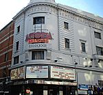
Centre Point is a building in Central London, comprising a 34-storey tower; a 9-storey block to the east including shops, offices, retail units and maisonettes; and a linking block between the two at first-floor level. It occupies 101–103 New Oxford Street and 5–24 St Giles High Street, WC1, with a frontage also to Charing Cross Road, close to St Giles Circus and almost directly above Tottenham Court Road tube station. The site was once occupied by a gallows, and the tower sits directly over the former route of St Giles High Street, which had to be re-routed for the construction. The building is 117 m (385 ft) high, has 34 floors and 27,180 m2 (292,563 sq ft) of floor space. Constructed from 1963 to 1966, it was one of the first skyscrapers in London, and as of 2009 was the city's joint 27th-tallest building. It stood empty from the time of its completion until 1975, and was briefly occupied by housing activists in 1974. Since 1995 it has been a Grade II listed building. In 2015 it was converted from office space to flats.

Excerpt from the Wikipedia article Centre Point (License: CC BY-SA 3.0, Authors, Images).

Centre Point
St Giles Square, London Bloomsbury (London Borough of Camden)

Geographical coordinates (GPS) Address Nearby Places
placeShow on map

Wikipedia: Centre PointContinue reading on Wikipedia

Geographical coordinates (GPS)

Latitude Longitude
N 51.515861111111 ° E -0.12969444444444 °
placeShow on map

Address

Exit 4 - Charing Cross Road

St Giles Square
WC2H 8AP London, Bloomsbury (London Borough of Camden)
England, United Kingdom
mapOpen on Google Maps

Centre Point London
Centre Point London
Share experience

Nearby Places

Denmark Street
Denmark Street

Denmark Street is a street on the edge of London's West End running from Charing Cross Road to St Giles High Street. It is near St Giles in the Fields Church and Tottenham Court Road station. The street was developed in the late 17th century and named after Prince George of Denmark. Since the 1950s it has been associated with British popular music, first via publishers and later by recording studios and music shops. A blue plaque was unveiled in 2014 commemorating the street's importance to the music industry. The street was originally residential, but became used for commercial purposes in the 19th century. At first, metalwork was a popular trade but it became most famous as Britain's "Tin Pan Alley" housing numerous music publishers' offices. This market declined in the 1960s to be replaced by music shops and independent recording studios. The Rolling Stones recorded at Regent Sound Studio at No. 4 and popular musicians, including David Bowie and the Small Faces, often socialised in the Gioconda café at No. 9. Elton John and Bernie Taupin wrote songs at offices on the street in the 1960s, while the Sex Pistols lived above No. 6, and recorded their first demos there. The comic book store Forbidden Planet and the Helter Skelter music bookshop have also been based on the street. In the 2010s, the surrounding area was redeveloped. Parts of Denmark Street are listed to protect them, but other parts, away from the street itself, are planned to be demolished.