Radnor Forest

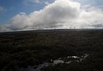
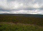
Radnor Forest (Welsh: Fforest Clud) is a rock dome composed of Silurian shales, mudstones and limestone in the historic county of Radnorshire, Powys, Mid Wales. It is a forest in the medieval sense of the word (an area of land set aside for hunting). It lies within the Welsh Marches region since Offa's Dyke lies nearby to the east. The area lies to the north of the Black Mountains and to the east of the Cambrian Mountains. Hergest Ridge is immediately to the south-east of the area (just across the English border into Herefordshire), near the small town of Kington. The highest point in the area is Rhos Fawr a broad plateau which reaches 660 metres (2,165 ft), and is equipped with a trig point to mark the summit. A similar plateau adjoining to the east, Black Mixen is the only Nuttall to have a communications mast (a radio transmitter) on its summit.
Excerpt from the Wikipedia article Radnor Forest (License: CC BY-SA 3.0, Authors, Images).Radnor Forest
Geographical coordinates (GPS) Address Nearby Places Show on map
Geographical coordinates (GPS)
| Latitude | Longitude |
|---|---|
| N 52.27 ° | E -3.17 ° |
Address
New Radnor
, New Radnor
Wales, United Kingdom
Open on Google Maps


