Cascob
OpenDomesdayPowys geography stubsVillages in Powys

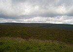
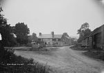
Cascob (Welsh: Casgob) is a small village in Powys. It is located in a valley five miles to the south-west of Knighton. The village is part of Whitton, Powys. The village is situated to the east of Radnor Forest, an area of moorland just within Wales. It also lies to the north-west of the small border town of Kington. In 1086, when the Domesday Book was compiled, Cascob was listed with no recorded population but within the hundred of Leintwardine. Additionally, it was counted under both Herefordshire and Shropshire.
Excerpt from the Wikipedia article Cascob (License: CC BY-SA 3.0, Authors, Images).Cascob
Ackwood Lane,
Geographical coordinates (GPS) Address Nearby Places Show on map
Geographical coordinates (GPS)
| Latitude | Longitude |
|---|---|
| N 52.283333333333 ° | E -3.1166666666667 ° |
Address
Ackwood Lane
Ackwood Lane
LD8 2NT
Wales, United Kingdom
Open on Google Maps


