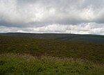
Black Mixen
Hewitts of WalesMountains and hills of PowysNuttallsPowys geography stubsRadnor Forest ... and 1 more
United Kingdom Site of Special Scientific Interest stubs

Black Mixen (Welsh: Y Domen Ddu) is a subsidiary summit of Rhos Fawr or Great Rhos in the Radnor Forest. The summit is large peat bog plateau. The summit is marked with a cairn, and is next to a radio transmitter and its building.Black Mixen is the only Nuttall to have a communications mast (a radio transmitter) on its summit. To the east is Bache Hill, to the south are the Black Mountains, to the west is the Great Rhos plateau. The summit cairn is probably of Bronze Age date, with most peaks in the area showing similar barrowss.
Excerpt from the Wikipedia article Black Mixen (License: CC BY-SA 3.0, Authors, Images).Black Mixen
Whimble Footpath,
Geographical coordinates (GPS) Address Nearby Places Show on map
Geographical coordinates (GPS)
| Latitude | Longitude |
|---|---|
| N 52.2718 ° | E -3.1789 ° |
Address
Whimble Footpath
LD8 2TL , New Radnor
Wales, United Kingdom
Open on Google Maps


