Battle of Jumonville Glen

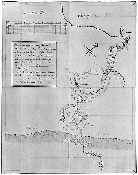
The Battle of Jumonville Glen, also known as the Jumonville affair, was the opening battle of the French and Indian War, fought on May 28, 1754, near present-day Hopwood and Uniontown in Fayette County, Pennsylvania. A company of provincial troops from Virginia under the command of Lieutenant Colonel George Washington, and a small number of Mingo warriors led by the chieftain Tanacharison (also known as the "Half King"), ambushed a force of 35 French Canadians under the command of Joseph Coulon de Jumonville. A larger French Canadian force had driven off a small crew attempting to construct a British fort under the auspices of the Ohio Company at present-day Pittsburgh, Pennsylvania, land claimed by the French. A British colonial force led by George Washington was sent to protect the fort under construction. The French Canadians sent Jumonville to warn Washington about encroaching on French-claimed territory. Washington was alerted to Jumonville's presence by Tanacharison, and they joined forces to ambush the French Canadian camp. Washington's force killed Jumonville and some of his men in the ambush and captured most of the others. The exact circumstances of Jumonville's death are a subject of historical controversy and debate. Since Britain and France were not then at war, the event had international repercussions, and was a contributing factor in the start of the Seven Years' War in 1756. After the action, Washington retreated to Fort Necessity, where Canadian forces from Fort Duquesne compelled his surrender. The terms of Washington's surrender included a statement (written in French, a language that Washington did not read) that admitted that Jumonville was assassinated. That document and others were used by the French and the Canadians to level accusations that Washington had ordered Jumonville's slaying.
Excerpt from the Wikipedia article Battle of Jumonville Glen (License: CC BY-SA 3.0, Authors, Images).Battle of Jumonville Glen
Jumonville Road, North Union Township
Geographical coordinates (GPS) Address Nearby Places Show on map
Geographical coordinates (GPS)
| Latitude | Longitude |
|---|---|
| N 39.879444444444 ° | E -79.645555555556 ° |
Address
Jumonville Road 798
15445 North Union Township
Pennsylvania, United States
Open on Google Maps


