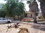
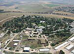
Al-Shajara, Palestine

Al-Shajara (Arabic: الشجرة) was a Palestinian Arab village depopulated by Israel during the 1948 Arab-Israeli War when its residents were forcefully evacutaed and became refugees. It was located 14 kilometers west of Tiberias on the main highway to Nazareth near the villages of Lubya and Hittin. The village was very close to the city of Nazareth, about 5 kilometers away. The village was the fourth largest by area in Tiberias district. Its economy was based on agriculture. In 1944/45 it had 2,102 dunams (505 acres) planted with cereals and 544 dunams (136 acres) either irrigated or fig and olive orchards. Al-Shajara was the home village of the cartoonist Naji al-Ali.
Excerpt from the Wikipedia article Al-Shajara, Palestine (License: CC BY-SA 3.0, Authors, Images).Al-Shajara, Palestine
Galil Tachton Regional Council
Geographical coordinates (GPS) Address Nearby Places Show on map
Geographical coordinates (GPS)
| Latitude | Longitude |
|---|---|
| N 32.754444444444 ° | E 35.398888888889 ° |
Address
1529500 Galil Tachton Regional Council
North District, Israel
Open on Google Maps


