RAF Haverfordwest
Royal Air Force stations in WalesRoyal Air Force stations of World War II in the United KingdomUse British English from May 2013

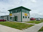
Royal Air Force Haverfordwest or more commonly RAF Haverfordwest, is a former Royal Air Force station located 2.1 miles (3.4 km) north of Haverfordwest, Pembrokeshire and 11 miles (18 km) south of Fishguard, Pembrokeshire, Wales. Situated north of Haverfordwest, at Withybush, in the community of Rudbaxton, its satellite airfield was RAF Templeton It was operational between 1943 and 1945 and was controlled by No. 17 (T) Group of RAF Coastal Command. On the 1 June 1946 the site was passed over to the Board of Trade.
Excerpt from the Wikipedia article RAF Haverfordwest (License: CC BY-SA 3.0, Authors, Images).RAF Haverfordwest
Fishguard Road,
Geographical coordinates (GPS) Address Nearby Places Show on map
Geographical coordinates (GPS)
| Latitude | Longitude |
|---|---|
| N 51.831388888889 ° | E -4.9636111111111 ° |
Address
Fishguard Road
SA62 4BT
Wales, United Kingdom
Open on Google Maps


