place

Traun (river)

Austria river stubsBraided rivers in EuropePages including recorded pronunciationsPages with German IPARivers of Austria
Rivers of Upper AustriaTraun basinTributaries of the DanubeUpper Austria geography stubs
0846 0847 Obertraun Looking west

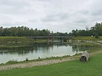
Traun (German: [ˈtʁaʊn] ) is a river in the Austrian state of Upper Austria. Its source is in the Totes Gebirge mountain range in Styria. It flows through the Salzkammergut area and the lakes Hallstätter See and Traunsee. The Traun is a right tributary of the Danube, which it meets near the city of Linz. Other towns along the river are Bad Aussee, Bad Ischl, Gmunden, Wels and Traun. The Traun is 155.9 km (96.9 mi) long, and has a basin area of 4,257 km2 (1,644 sq mi). Its average discharge at the mouth is 150 m3/s (5,300 cu ft/s).Until the late 19th century, it was only possible to reach Hallstatt (at the Hallstätter See) by boat or via narrow trails. However, this secluded and inhospitable landscape nevertheless counts as one of the first places of human settlement due to the rich sources of natural salt, which was mined for thousands of years, originally in the shape of hearts. Some of Hallstatt's oldest archaeological finds, such as a shoe-last celt – a long thin stone tool used to fell trees and to work wood – date back to around 5000 B.C. One of the first blacksmith's sites was excavated there. Active trade and thus wealth allowed for the development of a highly sophisticated society, hence the term Hallstatt culture. In 1846, a large prehistoric cemetery was discovered close by the current location of Hallstatt. There is little room for cemeteries so every ten years bones used to be exhumed and removed into an ossuary to make room for new burials. A collection of elaborately decorated skulls with the owners' names, professions, death dates inscribed on them is on display at the local chapel.

Excerpt from the Wikipedia article Traun (river) (License: CC BY-SA 3.0, Authors, Images).

Traun (river)
Traunradweg, Linz Solar-City

Geographical coordinates (GPS) Address Nearby Places
placeShow on map

Wikipedia: Traun (river)Continue reading on Wikipedia

Geographical coordinates (GPS)

Latitude Longitude
N 48.269166666667 ° E 14.372222222222 °
placeShow on map

Address

Traunradweg

Traunradweg
4030 Linz, Solar-City
Upper Austria, Austria
mapOpen on Google Maps

0846 0847 Obertraun Looking west
Share experience

Nearby Places

Florianerbahn
Florianerbahn

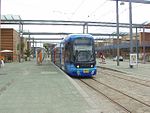
The Florianerbahn is a museum tramway in Upper Austria that is not operational due to construction work. It was built as a railway - a licensed narrow gauge Lokalbahn or branch line - between the independent commununity of Ebelsberg (today a district within Linz) and Sankt Florian. It was owned by the Lokalbahn Ebelsberg–St. Florian AG, but operated by the firm of Stern & Hafferl from Gmunden. Because the line had the character of a tramway (Überlandstraßenbahn) it switched over to providing tramway services in the wake of the annexation of Austria in 1938 – along with Stern & Hafferl's sister companies Elektrische Lokalbahn Unterach–See and Elektrische Lokalbahn Gmunden. The rail gauge is the same as that of the Linz tramway, 900 mm (2 ft 11+7⁄16 in), the line is electrified, operating at 600 V C. It ran regular services from 2 September 1913 to the end of 1973. From 1929 it was connected directly to the Linz tramway network at Ebelsberg, so that trailer coaches could run through from Linz to St. Florian. The line was officially opened on 1 September 1913. The specially decorated first train, consisting of a railcar and two carriages, left Sankt Florian at 6:22 and arrived at Ebelsberg at 6:50. 42 of the 96 places available were taken. After the fall in passenger numbers and the cessation of services on 31 December 1973 the line was taken over by the Austrian Society for Railway History (ÖGEG), and later by the Club Florianerbahn society and a section of the line reactivated as a museum railway. As of 2008 there were no museum services because much of the route is not usable: between Pichling and Bruck the line runs under the Western motorway and had to be lifted whilst construction work is going on. The track has since been replaced, but the catenary is still missing. Between Pichling and Ebelsberg a large section of the overgrown tracks has been removed to build a ring road and has not been fully replaced. The museum's vehicle collection in St. Florian can be visited if notice is given.