place

County of Castell

1709 establishments in the Holy Roman EmpireBavaria geography stubsCounties of the Holy Roman EmpireFranconian CircleGerman history stubs

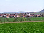
Castell was a county of northern Bavaria, Germany, ruling a string of territories in the historical region of Franconia, both east and west of Würzburg. Little is known about the noble Counts of Castell, although they were the counts of Kreis Gerolzhofen, Regierungsbezirk, and Unterfranken of Bavaria. They were a member of the Fränkische Grafenkolleg ("Franconian Counts College"). The two main branches of the House of Castell were Protestant Castell-Remlingen (later split into Castell-Castell) and Protestant and Catholic Castell-Rüdenhausen. Castell was composed of three territories (Flecken) and 28 villages, with about 10,000 inhabitants at the time of mediatisation. The County of Castell joined Bavaria in 1806.

Excerpt from the Wikipedia article County of Castell (License: CC BY-SA 3.0, Authors).

County of Castell
CV-383,

Geographical coordinates (GPS) Address Nearby Places
placeShow on map

Wikipedia: County of CastellContinue reading on Wikipedia

Geographical coordinates (GPS)

Latitude Longitude
N 49.75 ° E 10.333333333333 °
placeShow on map

Address

Loriguilla - Reva

CV-383
46393 , Residencial Reva
Comunidad Valenciana, España
mapOpen on Google Maps

Share experience

Nearby Places

Schwanberg
Schwanberg

Schwanberg is a mountain, or hill of higher elevation (474 m), in the rural district of Kitzingen, Regierungsbezirk Lower Franconia, Bavaria, Germany. It is part of the Steigerwald. In ancient times the mountain was used by the Celts as a refuge. It is probably safe to assume that the mountain has been considered sacred ground since. Later, the counts of Castell build a castle that still exists today. The southern slopes are used for viniculture; the top of the mountain is covered by forest. There are two burial sites on the Schwanberg, the vault of the princes of Castell, as well as the cemetery of the Protestant order Communität Casteller Ring. The latter emerged shortly after the 2nd World War from the Bavarian Girl Scout Movement "Bund Christlicher Pfadfinderinnen" (BCP). Members are still living on the mountain, where they maintain a retreat, the "Geistliches Zentrum Schwanberg" (Spiritual Center Schwanberg). According to legend, Hadeloga, a daughter of Franconian king Pippin, set her veil flying from the top. An abbey should be built wherever it landed. A shepherd named Kitz found the veil near the river Main, which allegedly was the origin of the abbey and the town of Kitzingen. A play written for children retells the story; it is occasionally performed by school children of the region. Parts of the region belonged to the county of Castell. One road leads from the Rödelsee to the top of the mountain. Towns and villages around the mountain are Castell, Rödelsee, Wiesenbronn, Iphofen, Birklingen and Greuth.