place

Großlangheim

Kitzingen (district)Lower Franconia geography stubsMunicipalities in Bavaria
Großlangheim in KT
Großlangheim in KT

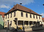
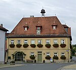
Großlangheim is a municipality in the district of Kitzingen in Bavaria in Germany.

Excerpt from the Wikipedia article Großlangheim (License: CC BY-SA 3.0, Authors, Images).

Großlangheim
Hohlweg,

Geographical coordinates (GPS) Address Nearby Places
placeShow on map

Wikipedia: GroßlangheimContinue reading on Wikipedia

Geographical coordinates (GPS)

Latitude Longitude
N 49.75 ° E 10.233333333333 °
placeShow on map

Address

Hohlweg 15
59929
Nordrhein-Westfalen, Deutschland
mapOpen on Google Maps

Großlangheim in KT
Großlangheim in KT
Share experience

Nearby Places

Schwanberg
Schwanberg

Schwanberg is a mountain, or hill of higher elevation (474 m), in the rural district of Kitzingen, Regierungsbezirk Lower Franconia, Bavaria, Germany. It is part of the Steigerwald. In ancient times the mountain was used by the Celts as a refuge. It is probably safe to assume that the mountain has been considered sacred ground since. Later, the counts of Castell build a castle that still exists today. The southern slopes are used for viniculture; the top of the mountain is covered by forest. There are two burial sites on the Schwanberg, the vault of the princes of Castell, as well as the cemetery of the Protestant order Communität Casteller Ring. The latter emerged shortly after the 2nd World War from the Bavarian Girl Scout Movement "Bund Christlicher Pfadfinderinnen" (BCP). Members are still living on the mountain, where they maintain a retreat, the "Geistliches Zentrum Schwanberg" (Spiritual Center Schwanberg). According to legend, Hadeloga, a daughter of Franconian king Pippin, set her veil flying from the top. An abbey should be built wherever it landed. A shepherd named Kitz found the veil near the river Main, which allegedly was the origin of the abbey and the town of Kitzingen. A play written for children retells the story; it is occasionally performed by school children of the region. Parts of the region belonged to the county of Castell. One road leads from the Rödelsee to the top of the mountain. Towns and villages around the mountain are Castell, Rödelsee, Wiesenbronn, Iphofen, Birklingen and Greuth.

Mainbernheim
Mainbernheim

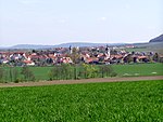
Mainbernheim (German pronunciation: [maɪnˈbɛʁnhaɪm]) is a municipality in Bavaria, Germany,4 kilometers to the south of Kitzingen (Landkreis, district of Kitzingen) in the direction of Nürnberg. It was first recorded in the chronicles of 889, during the reign of King Arnulf, the church being recognized by the influential bishopric of nearby Würzburg. The town was the site of a tariff house of the dukes of Ansbach and in thrall until 1397 to the duchy in the south, during the reign of King Wenceslaus. Mainbernheim was granted full rights as a city, although taxation privileges for Ansbach were extended until 1795. Today, Mainbernheim has a population of approximately 2200, the town having grown significantly due to new developments outside the city walls. The gummi-bear factory, Bären Schmidt, is the major industry there. Some extant points of interest include the 400-year-old farmhouses along Herrnstraße, which transverses the city from gate to gate and hosts several historic hotels and restaurants. Also along the main street are the Rathaus (city hall, 1548) and the adjacent Lutheran parish church, built on the foundations of an earlier cathedral (1498) after the Protestant Reformation (1750–1778). Just outside the main gate is the cemetery and arcade, dating from 1546 and containing fine examples of funerary flourishes. Off the main street, there is a recessed portal, which served as a hiding place for the Jews during the purges of World War II. The appearance of the inner city is little changed since Renaissance times.